Liado
Liado Hayk
Campo vulcanico · Ethiopia · 878 m
- Tipo
- Campo vulcanico
- Paese
- Ethiopia
- Regione
- Africa orientale / Main Ethiopian Rift Volcanic Province
- Altitudine
- 878 m
- Coordinate
- 9.570, 40.280
- Ultima eruzione
- Sconosciuto
- Contesto tettonico
- Rift zone / Continental crust (> 25 km)
- Forma vulcanica
- Cluster
- Roccia principale
- No Data (checked)
Sintesi geologica
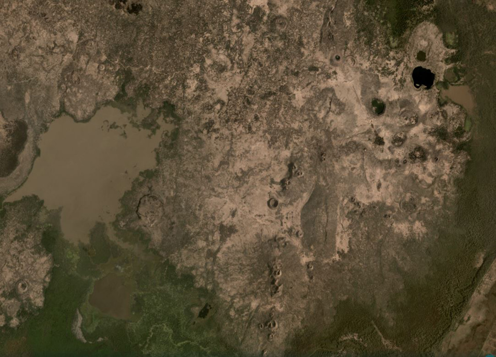
The Liado Hayk (Liado Lake) volcanic field consists of a dozen closely spaced maars and cinder cones with associated lava fields in the Awash plain NE of Dofen volcano. The morphology of the cones and maars suggested a late Pleistocene or Holocene age (Wood, 1979 p.c.).
Storia delle eruzioni
Cronologia dettagliata
Nessuna registrazione di eruzioni disponibile.
Link esterni
- Non ancora su Wikipedia (Italiano). Puoi contribuire su Wikidata.
- 🔗 Pagina originale Smithsonian GVP
⚠ Solo a scopo informativo. Non adatto a situazioni di emergenza.