Bilate River Field
Campo vulcanico · Ethiopia · 1700 m
- Tipo
- Campo vulcanico
- Paese
- Ethiopia
- Regione
- Africa orientale / Main Ethiopian Rift Volcanic Province
- Altitudine
- 1700 m
- Coordinate
- 7.070, 38.100
- Ultima eruzione
- Sconosciuto
- Contesto tettonico
- Intraplate / Continental crust (> 25 km)
- Forma vulcanica
- Cluster
- Roccia principale
- No Data (checked)
Sintesi geologica
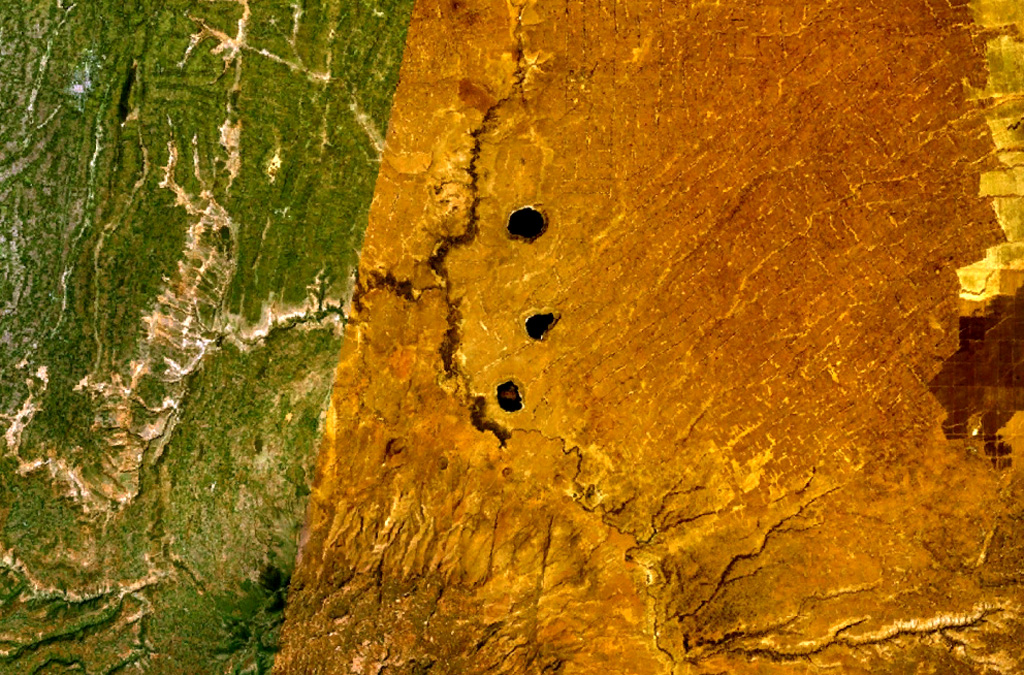
The Bilate River basin west of Lake Awasa contains a group of lake-filled maars and tuff rings of Pleistocene and probable Holocene age (WoldeGabriel 1987, pers. comm.). Active hot springs and fumaroles are located in this area.
Storia delle eruzioni
Cronologia dettagliata
Nessuna registrazione di eruzioni disponibile.
Link esterni
- Non ancora su Wikipedia (Italiano). Puoi contribuire su Wikidata.
- 🔗 Pagina originale Smithsonian GVP
⚠ Solo a scopo informativo. Non adatto a situazioni di emergenza.