Emuruangogolak
Vulcano a scudo · Kenya · 1285 m
- Tipo
- Vulcano a scudo
- Paese
- Kenya
- Regione
- Africa orientale / Kenyan Rift Volcanic Province
- Altitudine
- 1285 m
- Coordinate
- 1.500, 36.330
- Ultima eruzione
- 1910
- Contesto tettonico
- Rift zone / Continental crust (> 25 km)
- Forma vulcanica
- Shield
- Roccia principale
- Trachyte / Trachydacite
Sintesi geologica
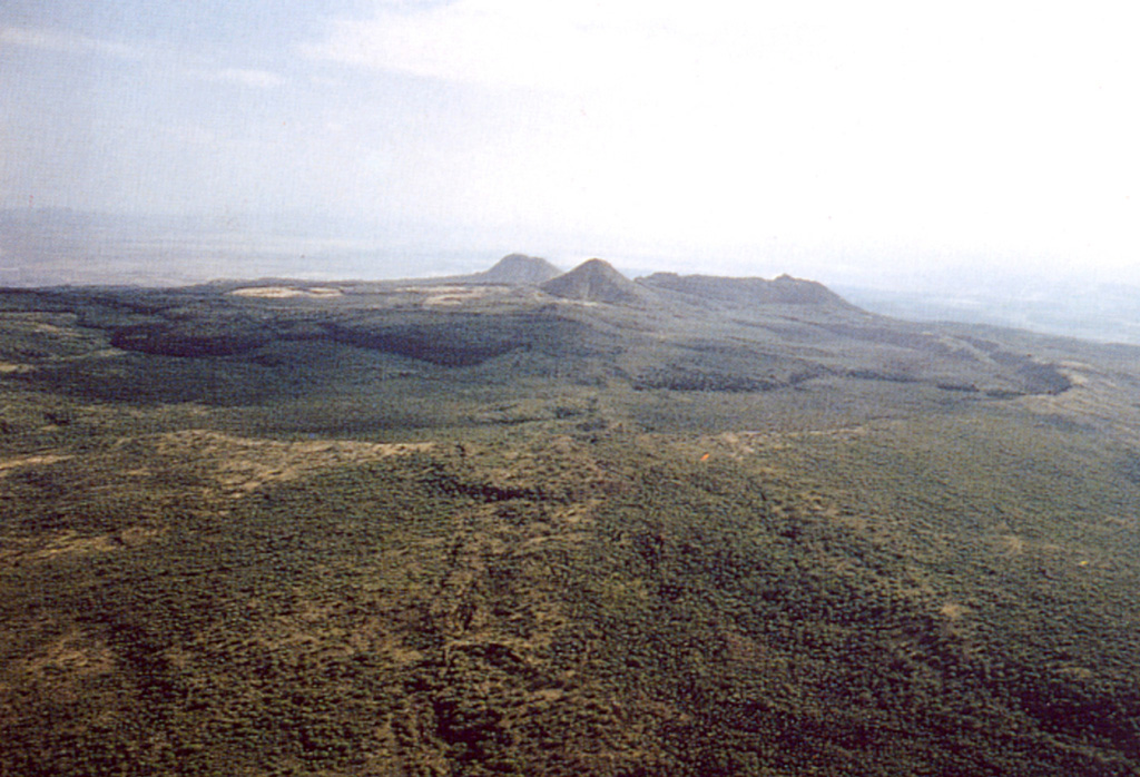
The broad Emuruangogolak shield volcano is situated at a narrow constriction in the Gregory Rift and almost completely straddles it. A 5 x 3.5 km summit caldera formed about 38,000 years ago. Since then trachytic and basaltic lava flows were erupted on the northern and southern flanks and within the caldera. A NNE-SSW-trending chain of lake-filled basaltic maars extends along the floor of the rift from the lower flanks of the volcano. Young lava flows were also erupted from vents along rift valley faults. Well-preserved cones erupted along rift-parallel faults cutting the volcano; the latest eruption produced a trachytic lava flow dated from secular magnetic variation measurements at about the beginning of the 20th century. Fumarolic activity and hot steaming ground occurs along NNE-trending fissures within the caldera and along the lower NW flanks.
Sintesi da Wikipedia
Riassunto in ingleseEmuruangogolak is an active shield volcano straddling the Gregory Rift in Kenya, in Eastern Africa. It has a 3.5-by-5.0-kilometre caldera on its summit. The last known eruption was a trachyte flow which occurred in 1910. Steam vents and fumarolic activity continues from fissures within the caldera and along the flanks of the volcano. Several maar lakes exist in the rift valley adjacent to the volcano. The volcano's summit is at an elevation of 1,285 metres (4,216 ft), and its formation is calculated to have been 38,000 years ago.
Wikipedia · CC BY-SA · Leggi l'articolo completo →
Storia delle eruzioni
Cronologia dettagliata
- 1910 (±50 anni)VEI 0Stima geologica1910-07-02 – In corsoSouth caldera rim
- 1700 (±100 anni)VEI 0Stima geologica1700 – In corsoSouth caldera rim
- 1300 (±150 anni)VEI 0Stima geologica1300 – In corsoNE flank
- 1230 (±150 anni)VEI 0Stima geologica1230 – In corsoNE flank
- 1160 (±150 anni)VEI 0Stima geologica1160 – In corsoNE flank
- 1120 (±150 anni)VEI 0Stima geologica1120 – In corsoNorth flank
- 6550 a.C. (±1500 anni)VEI ?Stima geologicaBCE 6550 – In corsoNorth flank
- 8050 a.C. (±1000 anni)VEI ?Stima geologicaBCE 8050 – In corsoNorth flank
Link esterni
⚠ Solo a scopo informativo. Non adatto a situazioni di emergenza.