Vai al contenuto principale

Hiri

Stratovulcano · Indonesia · 687 m

Hiri (left-center), a small 3-km-wide forested island immediately north of Ternate Island (lower right), is the northernmost of a chain of volcanic islands off the western coast of Halmahera.  North is to the upper left in this Space Shuttle image.  Little is known of this volcano, although it was mapped as Holocene in age.  In contrast to Hiri, the better-known Gamalama volcano that forms Ternate Island has been active during historical time, including a 1775 eruption from the small lake-filled maar visible on the NW coast of the island.
Hiri (left-center), a small 3-km-wide forested island immediately north of Ternate Island (lower right), is the northernmost of a chain of volcanic islands off the western coast of Halmahera. North is to the upper left in this Space Shuttle image. Little is known of this volcano, although it was mapped as Holocene in age. In contrast to Hiri, the better-known Gamalama volcano that forms Ternate Island has been active during historical time, including a 1775 eruption from the small lake-filled maar visible on the NW coast of the island. · Foto: NASA Space Shuttle image STS050-99-95, 1992 (http://eol.jsc.nasa.gov/).
Tipo
Stratovulcano
Paese
Indonesia
Regione
Western Pacific Volcanic Regions / Halmahera Volcanic Arc
Altitudine
687 m
Coordinate
0.897, 127.317
Ultima eruzione
Sconosciuto
Contesto tettonico
Subduction zone / Oceanic crust (< 15 km)
Forma vulcanica
Composite
Roccia principale
Basalt / Picro-Basalt
Sintesi geologica

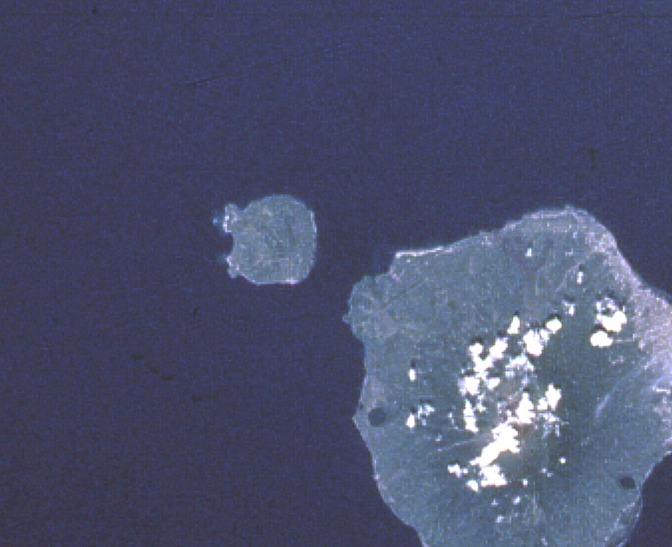
Hiri is a 3-km-wide forested island immediately north of Gamalama on Ternate Island, and is the northernmost of a chain of volcanic islands off the western coast of Halmahera. Two conical volcanic edifices are present within a larger caldera open to the W. Apandi and Sudana (1980) mapped it as Holocene in age, but no eruptions have been dated or reported.

Sintesi da Wikipedia

Hiri è una piccola isola boscosa larga 3 chilometri immediatamente a nord dell'isola di Ternate, nelle isole Molucche in Indonesia. Si trova nella parte più settentrionale di una catena di isole vulcaniche al largo della costa occidentale di Halmahera. È un vulcano conico che sale a 630 m. L'isola copre 6,7 km2 e nel 2015 contava 3.064 abitanti; è amministrata come un distretto (kecamatan) della città di Ternate.

Wikipedia · CC BY-SA · Leggi l'articolo completo

Storia delle eruzioni

Cronologia dettagliata

Nessuna registrazione di eruzioni disponibile.

Link esterni

⚠ Solo a scopo informativo. Non adatto a situazioni di emergenza.