Kita-Fukutokutai
Stratovulcano · Japan · 73 m (sottomarino)
- Tipo
- Stratovulcano
- Paese
- Japan
- Regione
- Pacifico nord-occidentale / Ogasawara Volcanic Arc
- Altitudine
- 73 m (sottomarino)
- Coordinate
- 24.417, 141.417
- Ultima eruzione
- 1954
- Contesto tettonico
- Subduction zone / Crustal thickness unknown
- Forma vulcanica
- Composite
- Roccia principale
- No Data (checked)
Sintesi geologica
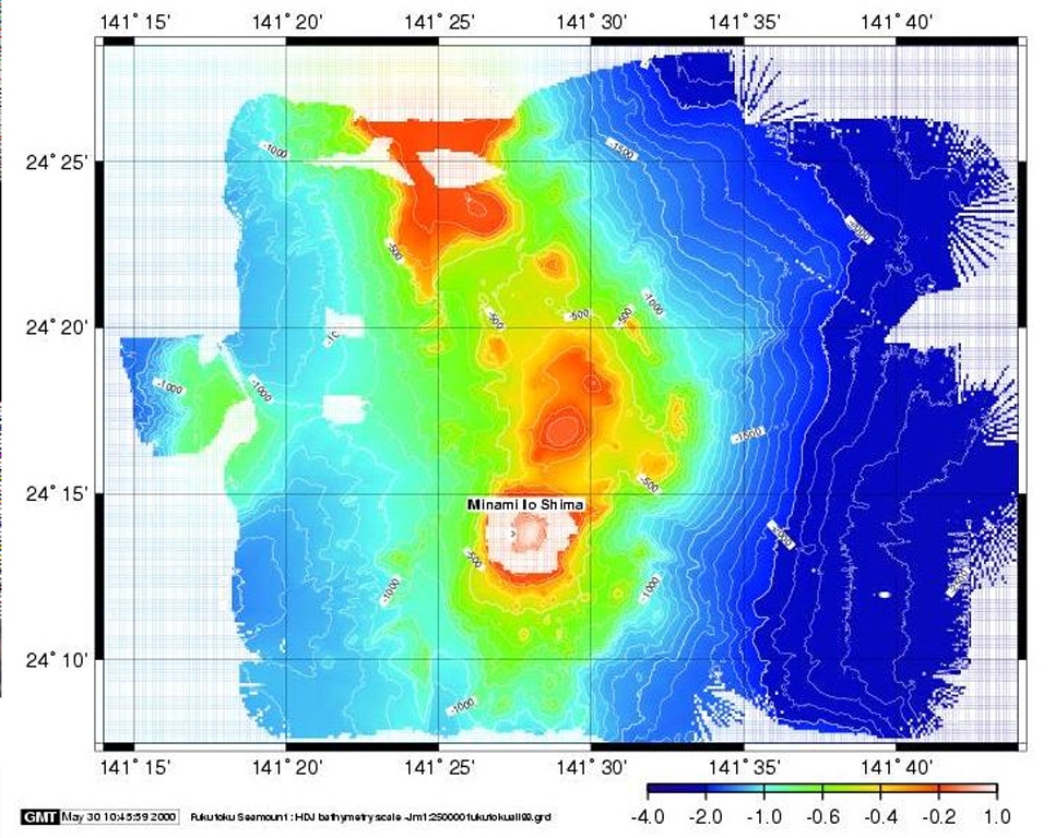
Kita-Fukutokutai is a submarine volcano halfway between the Ioto and Minami-Ioto islands. The volcano rises to within 73 m of the ocean surface. Water discoloration was reported several times beginning in 1937, and floating pumice was seen during 1953-54. In 1988 a fishing boat reported an eruption column about 100 m high, although the report was not confirmed at the time. The Japan Meteorological Agency has classified Kita-Fukutokutai as an active volcano.
Storia delle eruzioni
Riepilogo (VEI nel tempo)
Fai clic su una barra per vedere le singole eruzioni
Cronologia dettagliata
- 2001VEI 0Stima geologica2001-10-30 – 2001-10-3024.443 N, 141.378 E
- 1988VEI 1Stima geologica1988-01-27 – In corso
- 1959VEI 0Stima geologica1959-07-02 – In corso
- 1953VEI 0Osservata1953-07-02 – 1954-07-02
- 1947VEI 0Stima geologica1947-07-02 – In corso
- 1937VEI 0Stima geologica1937-07-02 – In corso
Link esterni
- Non ancora su Wikipedia (Italiano). Puoi contribuire su Wikidata.
- 🔗 Pagina originale Smithsonian GVP
⚠ Solo a scopo informativo. Non adatto a situazioni di emergenza.