South Sarigan Seamount
Stratovulcano · United States · 184 m (sottomarino)
- Tipo
- Stratovulcano
- Paese
- United States
- Regione
- Pacifico nord-occidentale / Mariana Volcanic Arc
- Altitudine
- 184 m (sottomarino)
- Coordinate
- 16.580, 145.780
- Ultima eruzione
- 2010
- Contesto tettonico
- Subduction zone / Crustal thickness unknown
- Forma vulcanica
- Composite
- Roccia principale
- No Data (checked)
Sintesi geologica
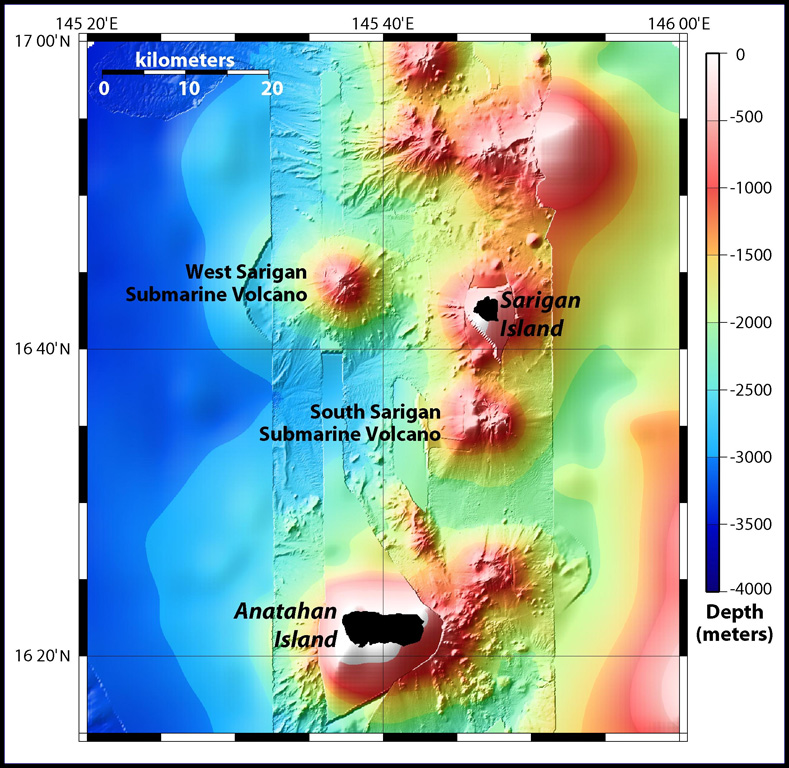
South Sarigan seamount, rising to within about 184 m of the ocean surface 12 km S of Sarigan Island, was the site of a short explosive submarine eruption in May 2010 that produced a plume of ash and steam to 12 km altitude. Sidescan sonar imagery taken in 2003 shows an irregular summit with multiple peaks, including a possibly young cone at about 350 m depth, and flank morphology suggests it is a frequently active volcano.
Storia delle eruzioni
Riepilogo (VEI nel tempo)
Fai clic su una barra per vedere le singole eruzioni
Cronologia dettagliata
- 2010VEI 3Osservata2010-05-27 – 2010-05-29Northern summit cone, 184 m below sea level
Link esterni
- Non ancora su Wikipedia (Italiano). Puoi contribuire su Wikidata.
- 🔗 Pagina originale Smithsonian GVP
⚠ Solo a scopo informativo. Non adatto a situazioni di emergenza.