Kinenin
Maar · Russia · 583 m
- Tipo
- Maar
- Paese
- Russia
- Regione
- Pacifico nord-occidentale / Central Kamchatka Volcanic Arc
- Altitudine
- 583 m
- Coordinate
- 57.350, 160.970
- Ultima eruzione
- 850
- Contesto tettonico
- Subduction zone / Continental crust (> 25 km)
- Forma vulcanica
- Minor
- Roccia principale
- Basalt / Picro-Basalt
Sintesi geologica
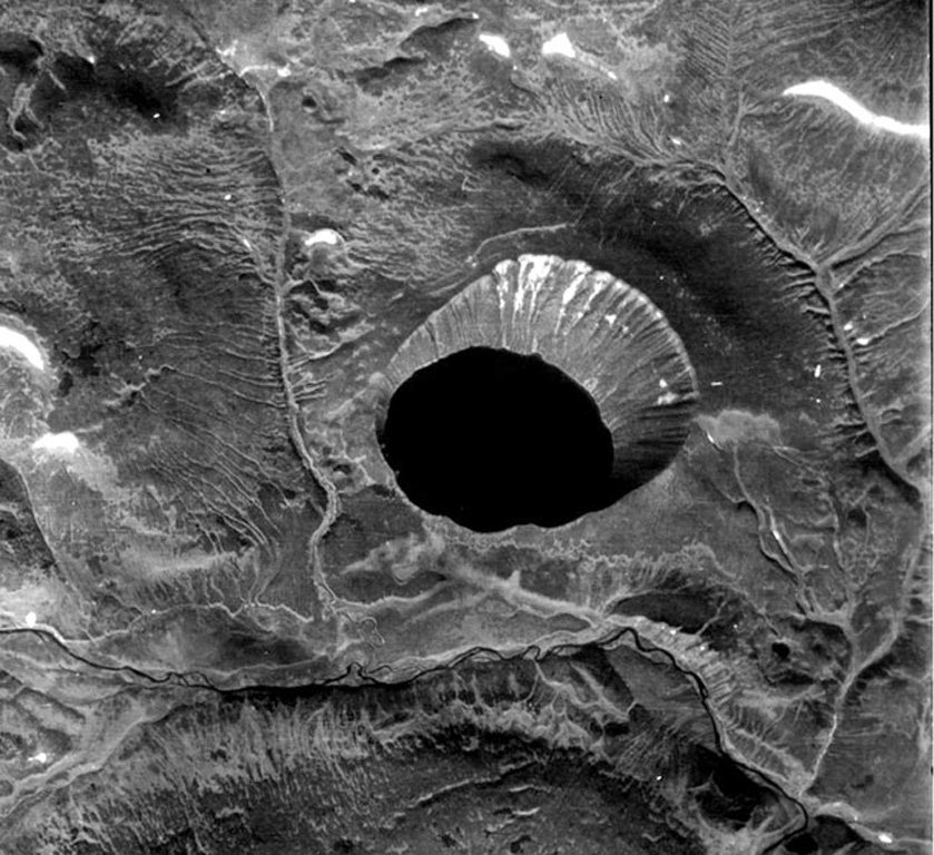
Kinenin maar lies at the eastern foot of the Sredinny Range, about 80 km NNW of Sheveluch volcano. The 2.5-km-wide, funnel-shaped maar was formed along the Kinenin River, a tributary of the Elovka. It is partially filled by a 1-km-wide lake whose surface is at 400 m elevation. The eastern rim at about 580 m is the high point of the crater. The eruption of Kinenin took place about 1,100 years ago, making it the youngest known maar in Kamchatka. Both silicic pyroclastic flows and mafic pyroclastic ejecta were produced, which were distributed primarily to the ENE. The location is north of the active Kamchatka subduction zone.
Storia delle eruzioni
Riepilogo (VEI nel tempo)
Fai clic su una barra per vedere le singole eruzioni
Cronologia dettagliata
- 850 (±50 anni)VEI 4Stima geologica850 – In corso
Link esterni
- Non ancora su Wikipedia (Italiano). Puoi contribuire su Wikidata.
- 🔗 Pagina originale Smithsonian GVP
⚠ Solo a scopo informativo. Non adatto a situazioni di emergenza.