Huaynaputina
Stratovulcano · Peru · 4679 m
- Tipo
- Stratovulcano
- Paese
- Peru
- Regione
- Sud America / Central Andean Volcanic Arc
- Altitudine
- 4679 m
- Coordinate
- -16.614, -70.854
- Ultima eruzione
- 1600
- Contesto tettonico
- Subduction zone / Continental crust (> 25 km)
- Forma vulcanica
- Composite
- Roccia principale
- Dacite
Sintesi geologica
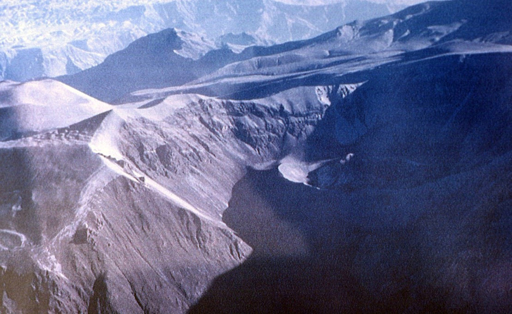
Huaynaputina (whose name means "new volcano") was the source of the largest historical eruption of South America in 1600 CE. It has no prominent topographic expression and lies within a 2.5-km-wide collapse depression and further excavated by glaciers within a Tertiary to Pleistocene edifice. Three overlapping ash cones with craters up to 100 m deep were constructed during the 1600 CE eruption on the floor of the older crater, whose outer flanks are heavily mantled by ash deposits from the 1600 eruption. This powerful fissure-fed eruption may have produced nearly 30 km3 of dacitic tephra, including pyroclastic flows and surges that traveled 13 km to the E and SE. Lahars reached the Pacific Ocean, 120 km away. The eruption caused substantial damage to the major cities of Arequipa and Moquengua.
Sintesi da Wikipedia
Riassunto in ingleseHuaynaputina is a volcano in a volcanic high plateau in southern Peru. Lying in the Central Volcanic Zone of the Andes, it was formed by the subduction of the oceanic Nazca Plate under the continental South American Plate. Huaynaputina is a large volcanic crater, which lacks an identifiable mountain profile, with an outer stratovolcano and three younger volcanic vents within an amphitheatre-shaped structure that is either a former caldera or a remnant of glacial erosion. The volcano has erupted dacitic magma.
Wikipedia · CC BY-SA · Leggi l'articolo completo →
Storia delle eruzioni
Cronologia dettagliata
- 1600VEI 6Osservata1600-02-17 – 1600-03-06Summit and south flank
- 7750 a.C. (±200 anni)VEI ?Stima geologicaBCE 7750 – In corso
Link esterni
⚠ Solo a scopo informativo. Non adatto a situazioni di emergenza.