Calabozos
Caldera · Chile · 3508 m
- Tipo
- Caldera
- Paese
- Chile
- Regione
- Sud America / Southern Andean Volcanic Arc
- Altitudine
- 3508 m
- Coordinate
- -35.558, -70.496
- Ultima eruzione
- Sconosciuto
- Contesto tettonico
- Subduction zone / Continental crust (> 25 km)
- Forma vulcanica
- Composite
- Roccia principale
- Dacite
Sintesi geologica
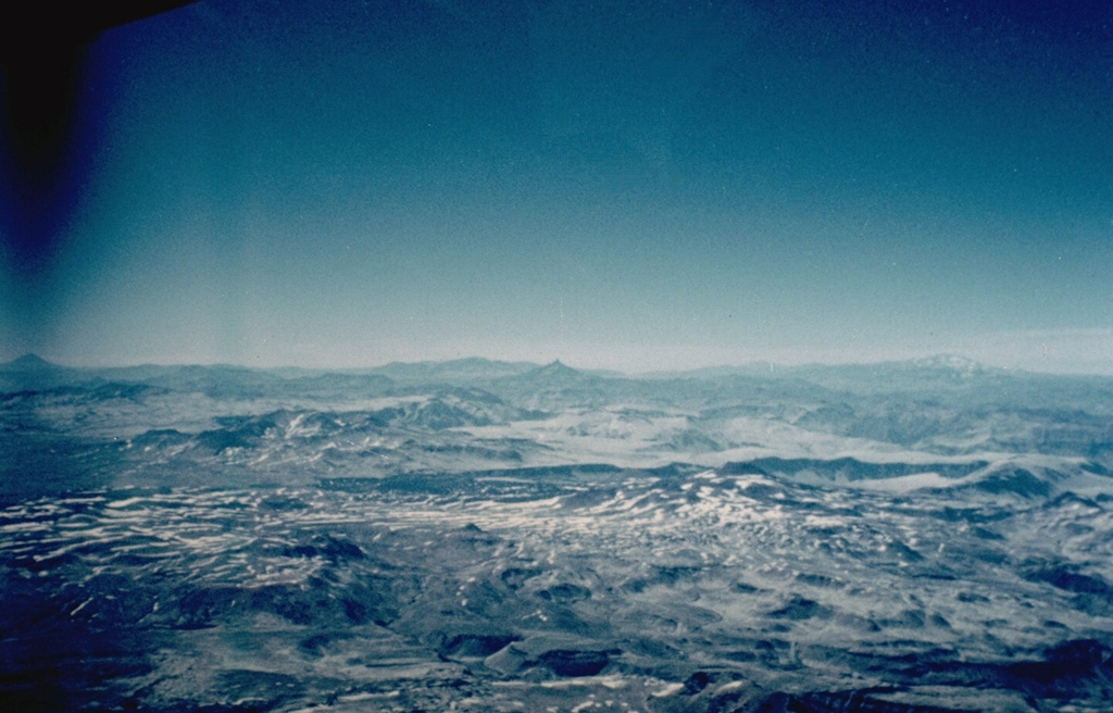
The composite late-Pleistocene Calabozos caldera (14 x 26 km) produced major rhyodacitic-to-dacitic ashflow sheets of ~200-500 km3 each, collectively referred to as the Loma Seca Tuff, at 800,000, 300,000, and 150,000 years ago. Eruptive activity has continued into the Holocene, forming the 20-25 km3 and the four clustered vents of Descabezado Chico near the western caldera rim. The late-Holocene 2.5 km3 Escorias dacitic lava flow from Descabezado Chico traveled more than 30 km S. Several hot-spring clusters are present along the margin of the central resurgent uplift within the caldera.
Sintesi da Wikipedia
Riassunto in ingleseCalabozos is a Holocene caldera in central Chile's Maule Region. Part of the Chilean Andes' volcanic segment, it is considered a member of the Southern Volcanic Zone (SVZ), one of the three distinct volcanic belts of South America. This most active section of the Andes runs along central Chile's western edge, and includes more than 70 of Chile's stratovolcanoes and volcanic fields. Calabozos lies in an extremely remote area of poorly glaciated mountains.
Wikipedia · CC BY-SA · Leggi l'articolo completo →
Storia delle eruzioni
Cronologia dettagliata
Nessuna registrazione di eruzioni disponibile.
Link esterni
⚠ Solo a scopo informativo. Non adatto a situazioni di emergenza.