Brennisteinsfjöll
Brennisteinsfjoll
File di crateri · Iceland · 610 m
- Tipo
- File di crateri
- Paese
- Iceland
- Regione
- Oceano Atlantico / Iceland Neovolcanic Rift Volcanic Province
- Altitudine
- 610 m
- Coordinate
- 63.933, -21.783
- Ultima eruzione
- 1341
- Contesto tettonico
- Rift zone / Oceanic crust (< 15 km)
- Forma vulcanica
- Cluster
- Roccia principale
- Basalt / Picro-Basalt
Sintesi geologica
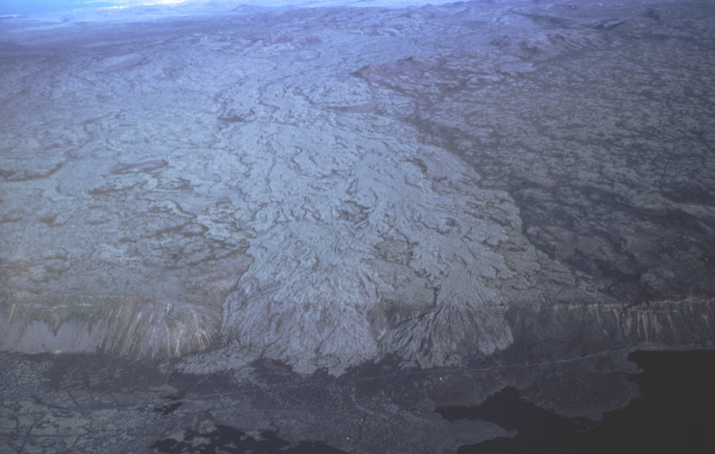
The Brennisteinsfjöll volcanic system, located east of Kleifarvatn lake, consists of a series of NE-SW-trending crater rows and small shield volcanoes. Postglacial and historical basaltic lavas cover a wide area. An eruption in 1000 CE was dated by its occurrence at the time of a meeting of the Icelandic outdoor parliament at Thingvellier. The most recent eruption took place in the 14th century.
Sintesi da Wikipedia
Brennisteinsfjöll è un piccolo sistema vulcanico situato sulla penisola di Reykjanes, nella regione di Suðurnes, nella parte sud-occidentale dell'Islanda.
Wikipedia · CC BY-SA · Leggi l'articolo completo →
Storia delle eruzioni
Riepilogo (VEI nel tempo)
Fai clic su una barra per vedere le singole eruzioni
Cronologia dettagliata
- 1341 (±1 anni)VEI 2Osservata1341 – In corsoGrafeldur (Selvogshraun)
- 1200VEI 2Stima geologica1200 – In corsoKongsfell
- 1000VEI 0Osservata1000-06-25 – In corsoEldborg at Lambafell
- 950VEI 2Stima geologica950 – In corsoRjupnadyngjur
- 910 (±75 anni)VEI 2Stima geologica910 – In corsoKista (Breiddalshraun)
- 875 (±50 anni)VEI 2Stima geologica875 – In corsoTvibollar
- 1040 a.C. (±75 anni)VEI 2Stima geologicaBCE 1040 – In corsoEldborg at Brennisteinsfjöllum
- 2660 a.C. (±75 anni)VEI 0Stima geologicaBCE 2660 – In corsoLeitin
- 9000 a.C.VEI 0Stima geologicaBCE 9000 – In corsoHeidin Há
Link esterni
⚠ Solo a scopo informativo. Non adatto a situazioni di emergenza.