Banco D. João de Castro
Don Joao de Castro Bank
Vulcano a scudo · Portugal · 13 m (sottomarino)
- Tipo
- Vulcano a scudo
- Paese
- Portugal
- Regione
- Oceano Atlantico / Azores-Terceira Rift Volcanic Province
- Altitudine
- 13 m (sottomarino)
- Coordinate
- 38.230, -26.630
- Ultima eruzione
- 1720
- Contesto tettonico
- Rift zone / Oceanic crust (< 15 km)
- Forma vulcanica
- Shield
- Roccia principale
- Basalt / Picro-Basalt
Sintesi geologica
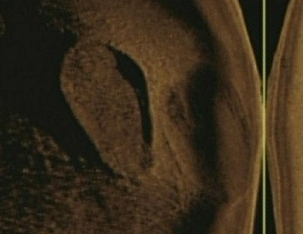
Don Joao de Castro Bank is a large submarine volcano that rises to within 13 m of the ocean surface roughly halfway between Terceira and San Miguel Islands. Pillow lavas form the base of the volcano, which is capped by basaltic hyaloclastites. A submarine eruption during December 1720 produced an ephemeral island that attained a length of 1.5 km and a height of about 250 m before it was eroded beneath the surface two years later. The volcano (also spelled Dom Joao de Castro) was named after the Portuguese hydrographic survey vessel that surveyed the bank in 1941. Two youthful craters, one tephra covered and the other sediment free, are located on the NW flank. The submarine volcano has a shallow fumarole field and remains seismically active.
Sintesi da Wikipedia
Riassunto in ingleseDom João de Castro Bank is a large submarine volcano located in the central north Atlantic Ocean, between the islands of São Miguel and Terceira in the archipelago of the Azores.
Wikipedia · CC BY-SA · Leggi l'articolo completo →
Storia delle eruzioni
Cronologia dettagliata
- 1997VEI 0Stima geologica1997-06-27 – 1997-07-16NW of Don Joao de Castro Bank
- 1720VEI 3Osservata1720-12-08 – 1720-12-26
Link esterni
⚠ Solo a scopo informativo. Non adatto a situazioni di emergenza.