Montagu Island
Vulcano a scudo · United Kingdom · 1370 m
- Tipo
- Vulcano a scudo
- Paese
- United Kingdom
- Regione
- Antartide e Scotia / South Sandwich Volcanic Arc
- Altitudine
- 1370 m
- Coordinate
- -58.445, -26.374
- Ultima eruzione
- 2007
- Contesto tettonico
- Subduction zone / Oceanic crust (< 15 km)
- Forma vulcanica
- Shield
- Roccia principale
- Basalt / Picro-Basalt
Sintesi geologica
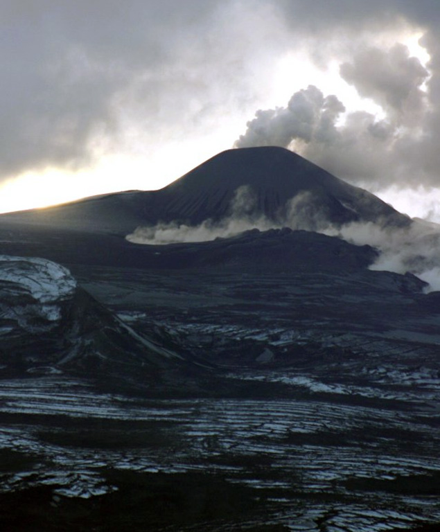
The largest of the South Sandwich Islands, Montagu consists of a massive shield volcano cut by a 6-km-wide ice-filled summit caldera. The summit of the 11 x 15 km island rises about 3,000 m from the sea floor between Bristol and Saunders Islands. Around 90% of the island is ice-covered; glaciers extending to the sea typically form vertical ice cliffs. The name Mount Belinda has been applied both to the high point at the southern end of the summit caldera and to the young central cone. Mount Oceanite, an isolated peak at the SE tip of the island, was the source of lava flows exposed at Mathias Point and Allen Point. There was no record of Holocene activity until MODIS satellite data, beginning in late 2001, revealed thermal anomalies consistent with lava lake activity. Apparent plumes and single anomalous pixels were observed intermittently on AVHRR images from March 1995 to February 1998, possibly indicating earlier volcanic activity.
Sintesi da Wikipedia
L'Isola Montagu è un'isola subantartica: la più grande delle Isole Sandwich Australi, situata nel Mare di Weddell.
Wikipedia · CC BY-SA · Leggi l'articolo completo →
Storia delle eruzioni
Cronologia dettagliata
- 2001VEI 1Osservata2001-10-01 – 2007-09-20NW of Mount Belinda
- 1996VEI 1Stima geologica1996-09-01 – In corso
Link esterni
⚠ Solo a scopo informativo. Non adatto a situazioni di emergenza.