ダビ山
Dubbi
成層火山 · Eritrea · 1625m
- タイプ
- 成層火山
- 国
- Eritrea
- 地域
- 東アフリカ / Afar Rift Volcanic Province
- 標高
- 1625m
- 座標
- 13.579, 41.809
- 最終噴火
- 1861年
- テクトニクス環境
- Rift zone / Intermediate crust (15-25 km)
- 火山地形
- Composite
- 主要岩石
- Basalt / Picro-Basalt
地質学的概要
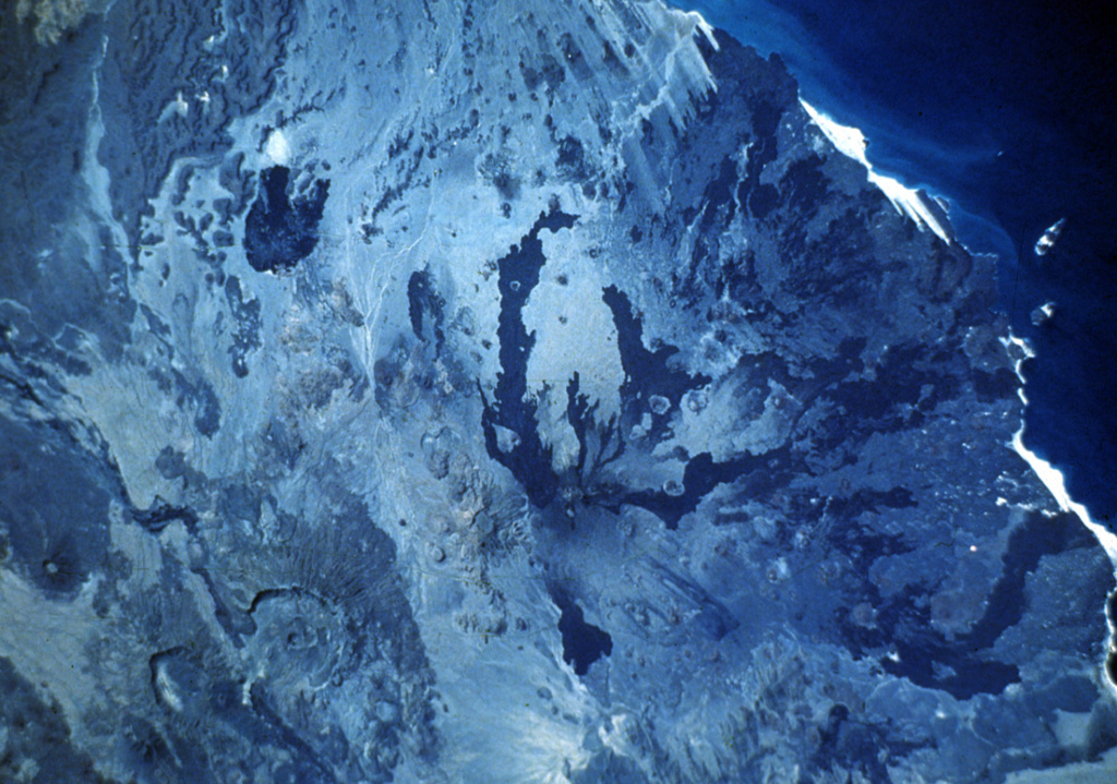
Dubbi, located east of the Erta Ale Range and south of the crystalline basement rocks of the Danakil Alps, is a large volcanic massif that rises above the western shore of the Red Sea. About 20 small cinder cones are located at the summit, and extensive basaltic lava fields to the north and NE, known as the Edd lava field, cover an area of 2700 km2 and reach the Red Sea coast. The two most-recent eruptive centers are fissure systems that extend NW-SE and NNE-SSW. The former produced lava flows that reached the Red Sea in 1400 CE. The second created 19 small craters at the summit in 1861. Ash fell more than 300 km from the volcano. Two villages were destroyed and more than 100 people were killed during Africa's largest eruption in historical time. Lava flows from the 1861 eruption traveled as far as 22 km and reached the coast.
Wikipedia の要約
要約が短いです。詳細は記事全文をご覧ください。
ダビ山 は、アフリカ大陸北東部に存在する活火山の1つである。山体には過去の噴火の結果形成されたカルデラも見られる。
Wikipedia · CC BY-SA · 記事全文を読む →
噴火履歴
詳細タイムライン
- 1900年VEI ?地質学的推定1900-07-02 ~ 進行中
- 1863年VEI 2地質学的推定1863-07-02 ~ 進行中
- 1861年VEI 3観測記録1861-05-08 ~ 1861-10-16
- 1400年VEI 2観測記録1400-07-15 ~ 進行中
外部リンク
⚠ 参考情報です。緊急対応には使用しないでください。