本文へスキップ
地図に戻る
比較

Groppo

火山原 · Ethiopia · 852m

The Groppo group contains several cones and lava flows, with a younger darker flow near the top of this December 2019 Planet Labs satellite image monthly mosaic (N is at the top; this image is approximately 42 km across). Several phreatomagmatic craters are visible, with complex groups of overlapping vents and at least one possible maar. Several of the scoria cones have craters that experienced flank collapse or rafting during their eruptions, including the northernmost cone.
The Groppo group contains several cones and lava flows, with a younger darker flow near the top of this December 2019 Planet Labs satellite image monthly mosaic (N is at the top; this image is approximately 42 km across). Several phreatomagmatic craters are visible, with complex groups of overlapping vents and at least one possible maar. Several of the scoria cones have craters that experienced flank collapse or rafting during their eruptions, including the northernmost cone. · 写真: Satellite image courtesy of Planet Labs Inc., 2020 (https://www.planet.com/).
タイプ
火山原
Ethiopia
地域
Eastern Africa Volcanic Regions / Afar Rift Volcanic Province
標高
852m
座標
11.816, 40.242
最終噴火
不明
テクトニクス環境
Rift zone / Intermediate crust (15-25 km)
火山地形
Cluster
地質学的概要

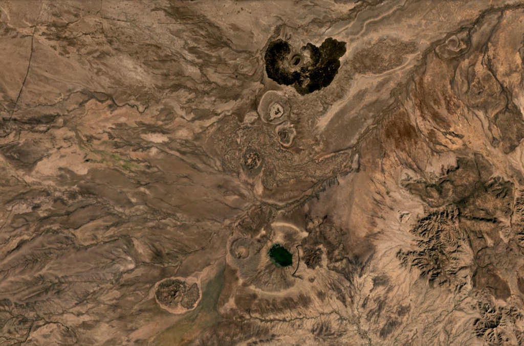
Groppo was identified by IAVCEI (1973) as a small alkali rhyolitic stratovolcano located in the western Afar near the Ethiopian escarpment, NE of Dessye. However, the nearest volcanic feature, identified in satellite imagery about 15 km NW from the given location, is a dark lava-flow field about 2.5 x 4.5 km in size, surrounding two small cones; two other smaller breached cones are nearby. The largest cone is about 300 x 500 m long, and 45 m high.

噴火履歴

詳細タイムライン

噴火記録はありません。

外部リンク

⚠ 参考情報です。緊急対応には使用しないでください。