Bilate River Field
火山原 · Ethiopia · 1700m
- タイプ
- 火山原
- 国
- Ethiopia
- 地域
- 東アフリカ / Main Ethiopian Rift Volcanic Province
- 標高
- 1700m
- 座標
- 7.070, 38.100
- 最終噴火
- 不明
- テクトニクス環境
- Intraplate / Continental crust (> 25 km)
- 火山地形
- Cluster
- 主要岩石
- No Data (checked)
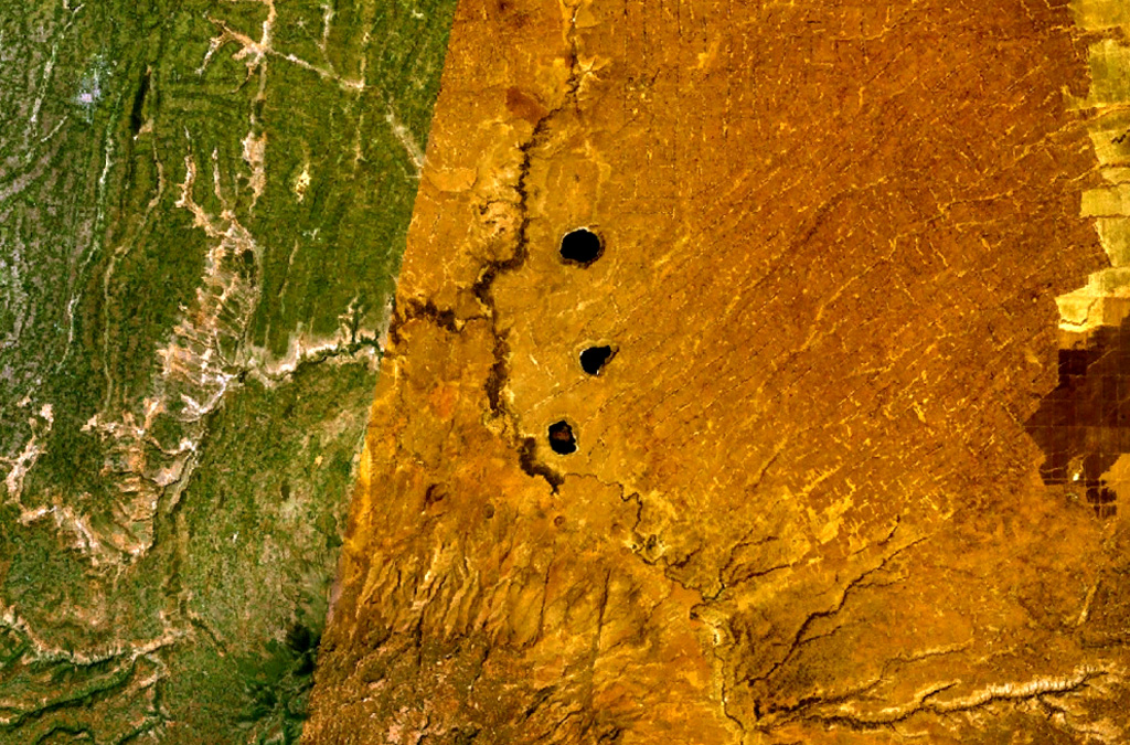
地質学的概要
The Bilate River basin west of Lake Awasa contains a group of lake-filled maars and tuff rings of Pleistocene and probable Holocene age (WoldeGabriel 1987, pers. comm.). Active hot springs and fumaroles are located in this area.
噴火履歴
詳細タイムライン
噴火記録はありません。
外部リンク
- 日本語版Wikipediaには未登録です。Wikidataで作成できます。
- 🔗 Smithsonian GVP 原典ページ
⚠ 参考情報です。緊急対応には使用しないでください。