Mount Silali
Silali
楯状火山 · Kenya · 1528m
- タイプ
- 楯状火山
- 国
- Kenya
- 地域
- 東アフリカ / Kenyan Rift Volcanic Province
- 標高
- 1528m
- 座標
- 1.150, 36.230
- 最終噴火
- -5050年
- テクトニクス環境
- Rift zone / Continental crust (> 25 km)
- 火山地形
- Shield
- 主要岩石
- Trachyte / Trachydacite
地質学的概要
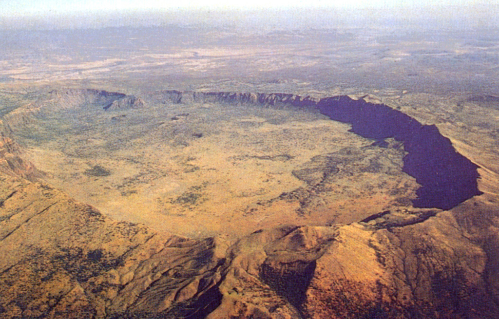
The 30-km-wide Silali trachytic shield volcano, the largest Quaternary volcano in the northern Gregory Rift, completely straddles the East African Rift. The 5 x 8 km summit caldera with 300 m deep walls is thought to have formed incrementally about 63,000 years ago, related to eruption of the Kantenmening basaltic and trachytic lava flows. A series of summit-area lava benches formed by eruptions from circumferential fissures is morphologically similar to Galapagos Islands volcanoes. The N, E, and S flanks are cut by a prominent broad rift zone 10 km wide and 30 km long, with numerous pyroclastic cones. Lava domes on the upper E flank formed during the late Pleistocene and early Holocene, until about 7,000 years ago. Youthful cones are common on the caldera floor and on the N and NE flanks; the youngest lava flows may be little more than a few hundred years old (Williams et al. 1984). Geothermal activity occurs within the caldera and on the upper E flanks.
Wikipedia の要約
英語版の要約Mount Silali is a dormant volcano in the Gregory Rift Valley, near Kapedo, Kenya. Silali is south of the Suguta Valley, which reaches northward to Lake Turkana, and is about 70 kilometres (43 mi) north of Lake Baringo.
Wikipedia · CC BY-SA · 記事全文を読む →
噴火履歴
詳細タイムライン
- 紀元前 5050年 (±2000年)VEI ?地質学的推定BCE 5050 ~ 進行中Upper east flank
- 紀元前 6050年 (±3000年)VEI ?地質学的推定BCE 6050 ~ 進行中Eastern part of caldera
- 紀元前 7050年 (±2000年)VEI ?地質学的推定BCE 7050 ~ 進行中Upper east flank
外部リンク
⚠ 参考情報です。緊急対応には使用しないでください。