McDonald Island
McDonald Islands
複成火山 · Australia · 263m
- タイプ
- 複成火山
- 国
- Australia
- 地域
- ソマリア・南極 / Kerguelen Hotspot Volcano Group
- 標高
- 263m
- 座標
- -53.039, 72.595
- 最終噴火
- 2005年
- テクトニクス環境
- Intraplate / Oceanic crust (< 15 km)
- 火山地形
- Composite
- 主要岩石
- Phonolite
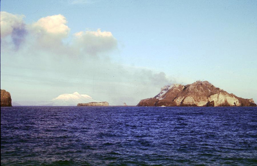
地質学的概要
The McDonald Islands are located on the Kerguelen Plateau about 75 km W of Heard Island. The largest island, McDonald, is composed of a layered phonolitic tuff plateau cut by phonolitic dikes and lava domes. A possible nearby active submarine center was inferred from phonolitic pumice that washed up on Heard Island in 1992. Volcanic plumes were observed in December 1996 and January 1997 from McDonald Island. During March 1997 the crew of a vessel that sailed near the island noted vigorous steaming from a vent on the N side of the island along with possible pyroclastic deposits and lava flows. A satellite image taken in November 2001 showed the island to have more than doubled in area since previous reported observations in November 2000.
噴火履歴
詳細タイムライン
- 2005年VEI 0観測記録2005-07-12 ~ 進行中
- 2004年VEI 1地質学的推定2004-11-14 ~ 2004-11-14
- 2001年VEI 1観測記録2001-05-03 ~ 進行中
- 1996年VEI 1観測記録1996-12-16 ~ 1997-02-10Northern part of McDonald Island
- 1992年VEI 0観測記録1992-12-16 ~ 進行中Submarine vent near McDonald Islands
外部リンク
⚠ 参考情報です。緊急対応には使用しないでください。