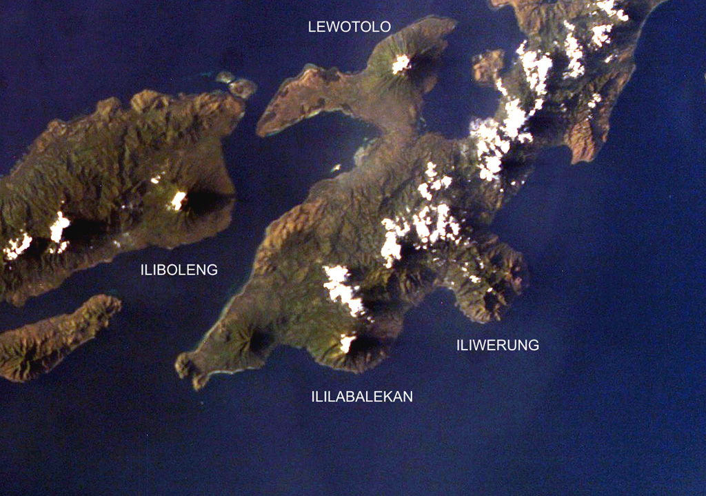
イリラバレカン山
Ililabalekan
成層火山 · Indonesia · 1018m
- タイプ
- 成層火山
- 国
- Indonesia
- 地域
- スンダ・バンダ / Sunda Volcanic Arc
- 標高
- 1018m
- 座標
- -8.550, 123.380
- 最終噴火
- 不明
- テクトニクス環境
- Subduction zone / Crustal thickness unknown
- 火山地形
- Composite
- 主要岩石
- Basalt / Picro-Basalt
地質学的概要
Ililabalekan volcano is situated on a prominent peninsula in SW Lembata (formerly Lomblen) Island. A satellitic cone was constructed on the SE flank of the steep-sided volcano. Four craters, one of which contains a lava dome and two small explosion pits, occur at the summit of Mount Labalekan. No historical eruptions are known from the volcano, although fumaroles are found near its summit.
噴火履歴
詳細タイムライン
噴火記録はありません。
外部リンク
⚠ 参考情報です。緊急対応には使用しないでください。