セルア島
Serua
成層火山 · Indonesia · 608m
- タイプ
- 成層火山
- 国
- Indonesia
- 地域
- スンダ・バンダ / Inner Banda Volcanic Arc
- 標高
- 608m
- 座標
- -6.312, 130.017
- 最終噴火
- 1921年
- テクトニクス環境
- Subduction zone / Oceanic crust (< 15 km)
- 火山地形
- Composite
- 主要岩石
- Andesite / Basaltic Andesite
地質学的概要
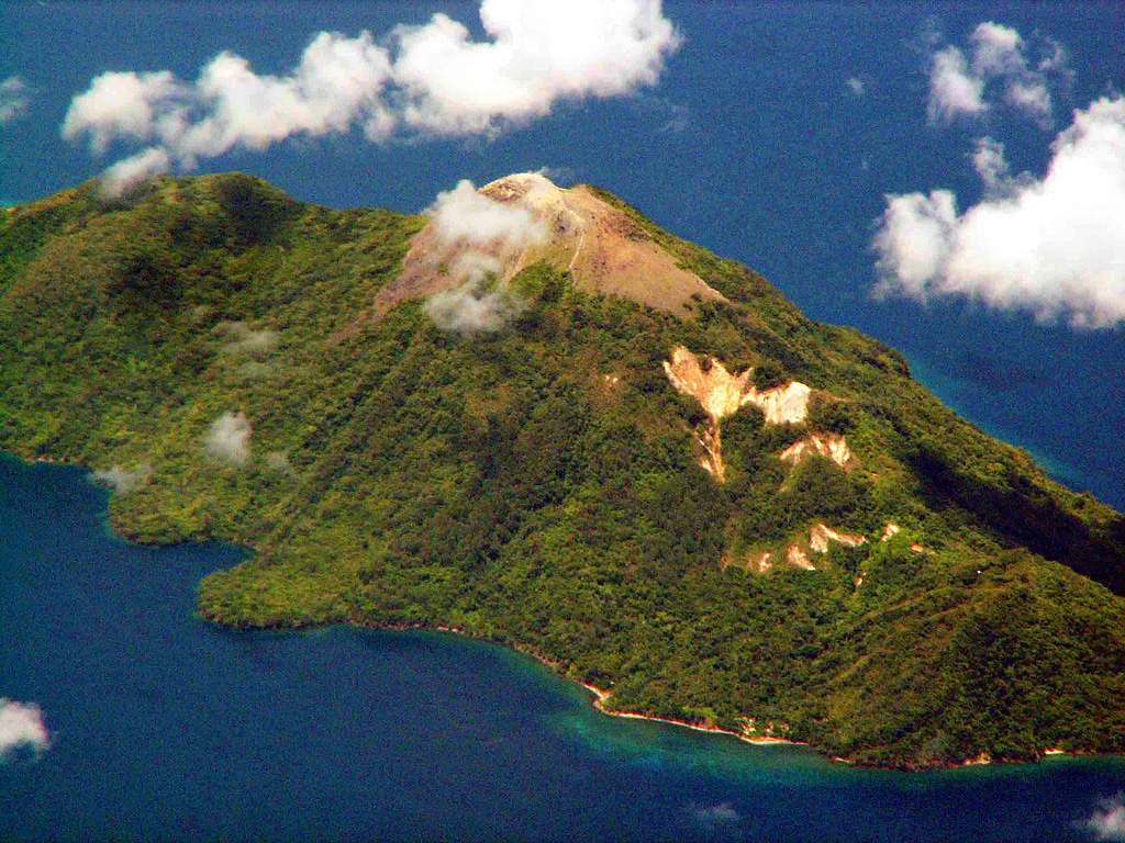
The 2 x 4 km island of Serua is the emergent summit of a volcano rising 3,600 m above the Banda Sea floor. A truncated central cone surrounded by an old crater wall is capped by the Gunung Wuarlapna lava dome. This andesitic volcano, also known as Legatala, lies near the center of the Banda arc and has had many eruptions recorded since the 17th century.
噴火履歴
概要 (VEI時系列)
バーをクリックすると個別の噴火が表示されます
詳細タイムライン
- 1921年VEI 2観測記録1921-09-18 ~ 進行中Summit and south flank
- 1919年VEI 2観測記録1919-11-16 ~ 進行中
- 1859年VEI 2観測記録1859-07-02 ~ 進行中
- 1858年VEI 2観測記録1858-07-02 ~ 進行中
- 1846年VEI 2観測記録1846-09-16 ~ 進行中
- 1845年VEI 2地質学的推定1845-07-02 ~ 進行中
- 1844年VEI 2観測記録1844-08-16 ~ 1844-09-16
- 1694年VEI 3観測記録1694 ~ 進行中
- 1693年VEI 4観測記録1693-06-04 ~ 1693-07
- 1692年VEI ?地質学的推定1692-06-04 ~ 進行中
- 1687年VEI 3観測記録1687-06-15 ~ 進行中
- 1683年VEI 3観測記録1683 ~ 進行中
外部リンク
⚠ 参考情報です。緊急対応には使用しないでください。