本文へスキップ
地図に戻る
比較

小田萌山

Odamoisan [Tebenkov]

成層火山 · Japan - administered by Russia · 1208m

The vegetated summit of Odamoisan (also called Tebenkov) is in the center of this September 2019 Planet Labs satellite image monthly mosaic (N is at the top; this image is approximately 9 km across). South of the summit is the unvegetated Machekh crater with continuing geothermal activity. The unvegetated cone to the SW is Etorofu-Yakeyama, or the Grozny Group.
The vegetated summit of Odamoisan (also called Tebenkov) is in the center of this September 2019 Planet Labs satellite image monthly mosaic (N is at the top; this image is approximately 9 km across). South of the summit is the unvegetated Machekh crater with continuing geothermal activity. The unvegetated cone to the SW is Etorofu-Yakeyama, or the Grozny Group. · 写真: Satellite image courtesy of Planet Labs Inc., 2019 (https://www.planet.com/).
タイプ
成層火山
Japan - administered by Russia
地域
Northwestern Pacific Volcanic Regions / Kuril Volcanic Arc
標高
1208m
座標
45.028, 147.918
最終噴火
不明
テクトニクス環境
Subduction zone / Intermediate crust (15-25 km)
火山地形
Composite
地質学的概要

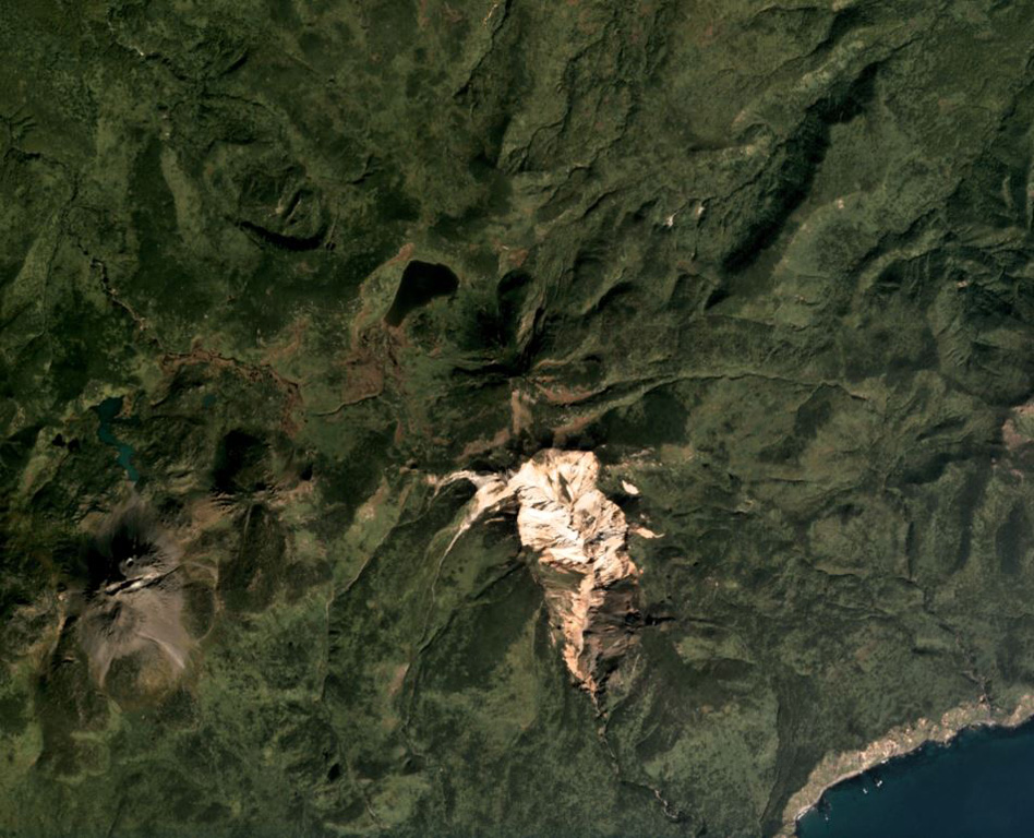
Odamoisan (also known as Tebenkov), lies in the center of Iturup Island along the E coast. This forested andesitic volcano lies immediately NE of the Etorofu-Yakeyama (Ivan Grozny) dome complex. The large Machekh crater, which displays strong fumarolic activity, lies immediately south. There have been no observed eruptions.

Wikipedia の要約

要約が短いです。詳細は記事全文をご覧ください。

小田萌山(おだもいさん)は択捉島にある火山。

Wikipedia · CC BY-SA · 記事全文を読む

噴火履歴

詳細タイムライン

噴火記録はありません。

外部リンク

⚠ 参考情報です。緊急対応には使用しないでください。