Barkhatnaya
Barkhatnaya Sopka
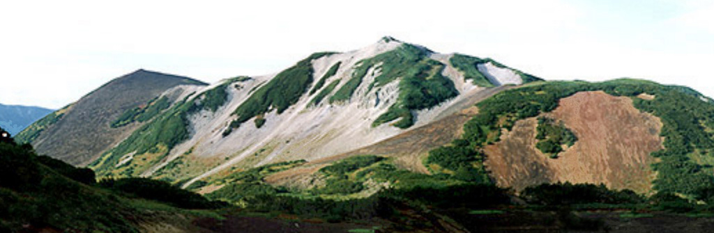
火山原 · Russia · 874m
- タイプ
- 火山原
- 国
- Russia
- 地域
- 北西太平洋 / Kuril Volcanic Arc
- 標高
- 874m
- 座標
- 52.802, 158.240
- 最終噴火
- -3550年
- テクトニクス環境
- Subduction zone / Continental crust (> 25 km)
- 火山地形
- Cluster
- 主要岩石
- Basalt / Picro-Basalt
地質学的概要
The Barkhatnaya Sopka group of Pleistocene andesitic-to-rhyolitic lava domes and Holocene basaltic pyroclastic cones is located along the Paratunka River about 30 km NNW of Gorely volcano. The cinder cones are sitting on an uplifted block of eroded Miocene-Pliocene rocks. Most of the younger cones lie on the S and SE sides of the volcanic field. The Barkhatnaya cinder cone formed about 3,000-4,000 years ago (Ponomareva, 1992 p.c.).
噴火履歴
概要 (VEI時系列)
バーをクリックすると個別の噴火が表示されます
詳細タイムライン
- 紀元前 3550年VEI ?地質学的推定BCE 3550 ~ 進行中
外部リンク
⚠ 参考情報です。緊急対応には使用しないでください。