Shisheika
溶岩ドーム · Russia · 355m
- タイプ
- 溶岩ドーム
- 国
- Russia
- 地域
- 北西太平洋 / Central Kamchatka Volcanic Arc
- 標高
- 355m
- 座標
- 57.153, 161.090
- 最終噴火
- -2240年
- テクトニクス環境
- Subduction zone / Continental crust (> 25 km)
- 火山地形
- Minor (Basaltic)
- 主要岩石
- Andesite / Basaltic Andesite
地質学的概要
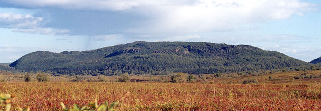
The andesitic Shisheika lava dome lies far to the west of the crest of the Sredinny Range, near the mouth of the Shishei River. The dome and associated lava flows were erupted about 4,200 years ago during one of several Holocene eruptions on the lower flanks of the Sredinny Range.
噴火履歴
概要 (VEI時系列)
バーをクリックすると個別の噴火が表示されます
詳細タイムライン
- 紀元前 2240年VEI ?地質学的推定BCE 2240 ~ 進行中
外部リンク
- 日本語版Wikipediaには未登録です。Wikidataで作成できます。
- 🔗 Smithsonian GVP 原典ページ
⚠ 参考情報です。緊急対応には使用しないでください。