Dutton
成層火山 · United States · 1465m
- タイプ
- 成層火山
- 国
- United States
- 地域
- 北アメリカ / Aleutian Ridge Volcanic Arc
- 標高
- 1465m
- 座標
- 55.183, -162.276
- 最終噴火
- 不明
- テクトニクス環境
- Subduction zone / Continental crust (> 25 km)
- 火山地形
- Composite
- 主要岩石
- Andesite / Basaltic Andesite
地質学的概要
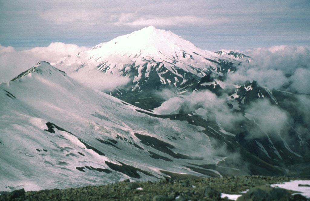
The Mount Dutton volcanic center east of Cold Bay near the tip of the Alaska Peninsula consists of a glacier-covered central lava dome complex. Early andesitic lava flows and late-stage dacitic domes have been partially removed by one or more edifice collapses about 5100-6800 years ago. Debris avalanches traveled west and south, reaching Belkofski Bay. The important regional fishing center of King Cove lies less than 15 km from the volcano, and the village's airstrip is built on top of the southern avalanche deposit. A steep-sided complex of lava domes forms the summit, and young block-and-ash flow deposits extend to the east. Two small unglaciated lava domes on the NE flank 3.5 km from the summit are also of Holocene age. Major earthquake swarms near the volcano were recorded in 1984-85 and 1988.
噴火履歴
詳細タイムライン
噴火記録はありません。
外部リンク
- 日本語版Wikipediaには未登録です。Wikidataで作成できます。
- 🔗 Smithsonian GVP 原典ページ
⚠ 参考情報です。緊急対応には使用しないでください。