Nejapa-Miraflores
割れ目火口 · Nicaragua · 360m
- タイプ
- 割れ目火口
- 国
- Nicaragua
- 地域
- 中央アメリカ・カリブ海 / Central America Volcanic Arc
- 標高
- 360m
- 座標
- 12.120, -86.320
- 最終噴火
- 1060年
- テクトニクス環境
- Subduction zone / Continental crust (> 25 km)
- 火山地形
- Cluster
- 主要岩石
- Basalt / Picro-Basalt
地質学的概要
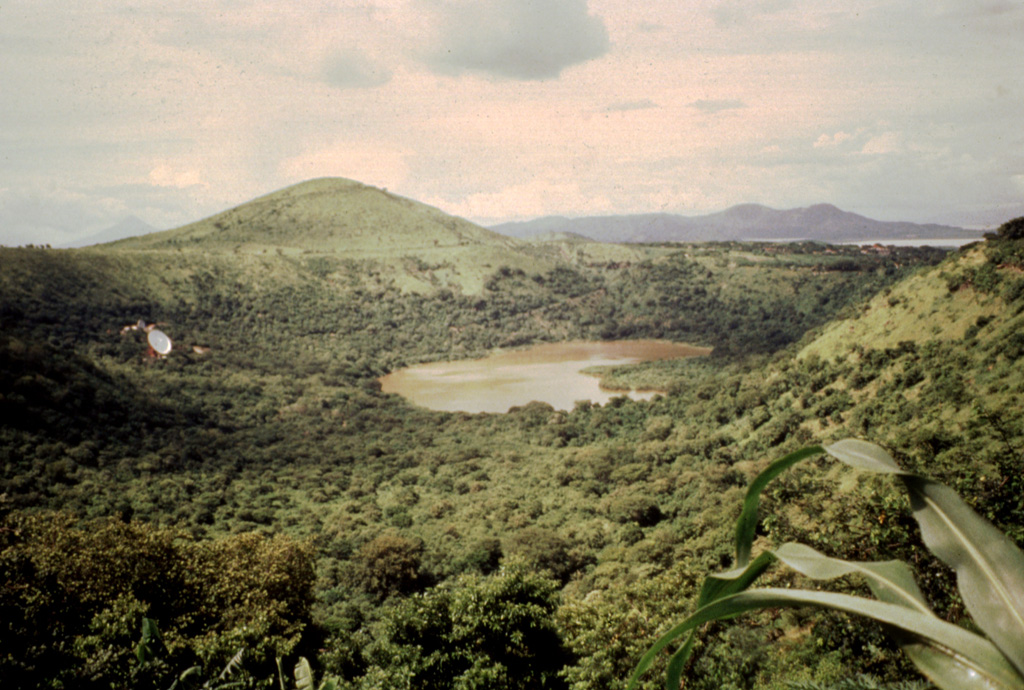
The Nejapa-Miraflores alignment (also known as Nejapa-Ticoma), ~10 km S of Apoyeque near the western margin of the Nicaraguan graben, cuts through the western part of the capital city of Managua and marks the right-lateral offset of the volcanic arc in Nicaragua. This group of features has erupted tholeiitic basaltic rocks similar to those from mid-ocean ridges, with about 40 eruptions during the past 30,000 years, the most recent of which (from Asososca maar) occurred about 1,250 years ago. A series of pit craters and fissure vents extends into Lake Managua and is continuous with the volcanic vents on the Chiltepe peninsula. An area of maars and tuff cones perpendicular to the N-S trend of the alignment forms the scalloped shoreline of Lake Managua. Laguna Tiscapa crater is located several kilometers to the east near the central part of the city of Managua. The elongated Nejapa and Ticoma pit craters are surrounded by small basaltic cinder cones and tuff cones.
噴火履歴
詳細タイムライン
- 1060年 (±100年)VEI 3地質学的推定1060 ~ 進行中Nejapa maar
- 紀元前 550年 (±500年)VEI ?地質学的推定BCE 550 ~ 進行中
- 紀元前 3050年 (±500年)VEI ?地質学的推定BCE 3050 ~ 進行中
- 紀元前 4390年 (±100年)VEI ?地質学的推定BCE 4390 ~ 進行中El Hormigón
- 紀元前 5230年 (±200年)VEI ?地質学的推定BCE 5230 ~ 進行中
- 紀元前 5350年 (±200年)VEI ?地質学的推定BCE 5350 ~ 進行中
- 紀元前 7300年 (±3150年)VEI ?地質学的推定BCE 7300 ~ 進行中
- 紀元前 7430年 (±300年)VEI ?地質学的推定BCE 7430 ~ 進行中Refinería crater
外部リンク
- 日本語版Wikipediaには未登録です。Wikidataで作成できます。
- 🔗 Smithsonian GVP 原典ページ
⚠ 参考情報です。緊急対応には使用しないでください。