Chacana
カルデラ · Ecuador · 4643m
- タイプ
- カルデラ
- 国
- Ecuador
- 地域
- 南アメリカ / Northern Andean Volcanic Arc
- 標高
- 4643m
- 座標
- -0.375, -78.250
- 最終噴火
- 1773年
- テクトニクス環境
- Subduction zone / Continental crust (> 25 km)
- 火山地形
- Caldera
- 主要岩石
- Rhyolite
地質学的概要
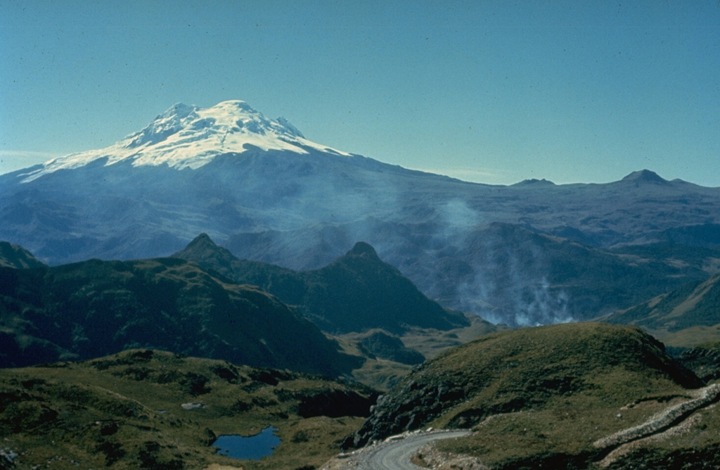
Chacana is a massive, eroded caldera complex of Pliocene-Holocene age that forms one of the largest rhyolitic centers of the northern Andes. The caldera is 32 km long in the N-S direction and 18-24 km wide E-W. It was constructed during three cycles of andesitic-to-rhyolitic volcanism, with major eruptions about 240,000, 180,00, and 160,000 years ago. Dacitic lava flows were erupted from caldera-floor fissures between about 30,000 and 21,000 years ago. Numerous lava domes were constructed within the caldera, which has been the source of frequent explosive eruptions throughout the Holocene as well as historical lava flows during the 18th century. The massive Antisana stratovolcano was constructed immediately to the SE.
Wikipedia の要約
英語版の要約Chacana is a large 32-km long - 18–24 km wide caldera that has erupted in historical times. It forms one of the largest rhyolite centers in the Northern Andes with major eruptions over the past 240,000, 180,00, and 160,000 years ago and has had andesitic-rhyolitic volcanism. With dacitic lava flows continuing into historical times. Lava domes were also constructed in the Holocene. Chacana is located 30 km from Quito and the large Antisana volcano is constructed to the southeast.
Wikipedia · CC BY-SA · 記事全文を読む →
噴火履歴
詳細タイムライン
- 1773年VEI 0観測記録1773 ~ 進行中South part of caldera
- 1760年VEI 0観測記録1760 ~ 進行中SW flank
- 紀元前 50年VEI ?地質学的推定BCE 50 ~ 進行中
- 紀元前 1580年 (±10年)VEI ?地質学的推定BCE 1580 ~ 進行中
- 紀元前 8050年VEI ?地質学的推定BCE 8050 ~ 進行中
外部リンク
⚠ 参考情報です。緊急対応には使用しないでください。