ブレンニステインスフィヨットル
Brennisteinsfjoll
火口列 · Iceland · 610m
- タイプ
- 火口列
- 国
- Iceland
- 地域
- 大西洋 / Iceland Neovolcanic Rift Volcanic Province
- 標高
- 610m
- 座標
- 63.933, -21.783
- 最終噴火
- 1341年
- テクトニクス環境
- Rift zone / Oceanic crust (< 15 km)
- 火山地形
- Cluster
- 主要岩石
- Basalt / Picro-Basalt
地質学的概要
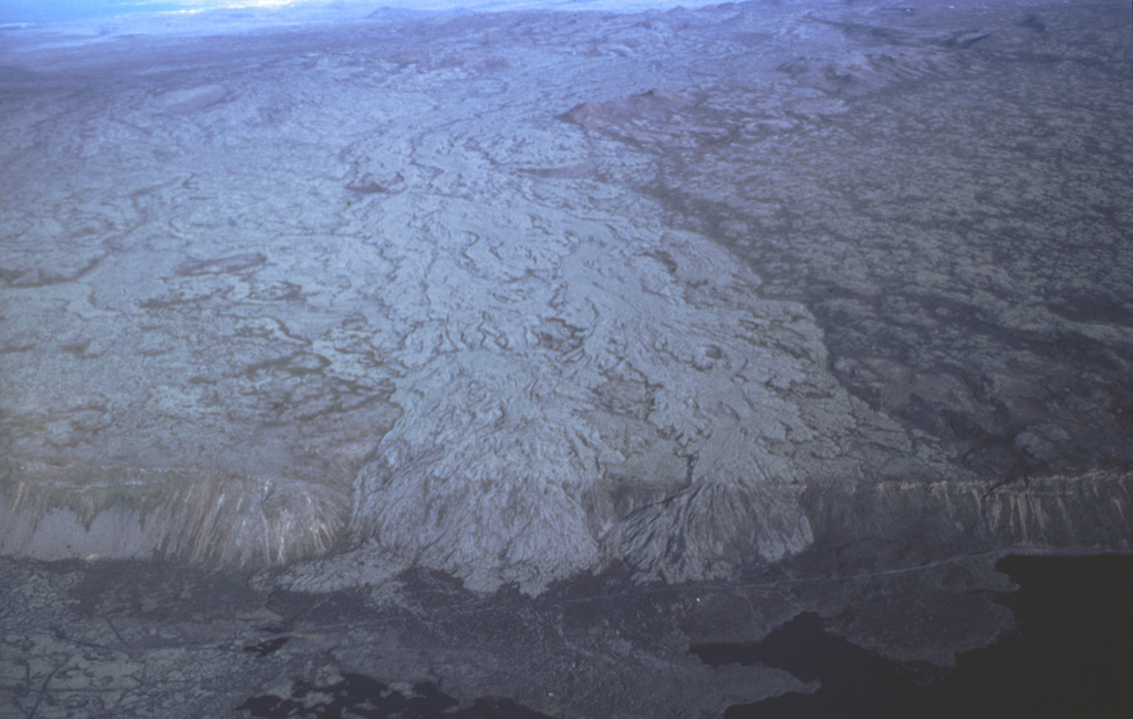
The Brennisteinsfjöll volcanic system, located east of Kleifarvatn lake, consists of a series of NE-SW-trending crater rows and small shield volcanoes. Postglacial and historical basaltic lavas cover a wide area. An eruption in 1000 CE was dated by its occurrence at the time of a meeting of the Icelandic outdoor parliament at Thingvellier. The most recent eruption took place in the 14th century.
Wikipedia の要約
英語版の要約Brennisteinsfjöll is a minor volcanic system, with crater rows and small shield volcanoes on the Reykjanes Peninsula in southwest Iceland.
Wikipedia · CC BY-SA · 記事全文を読む →
噴火履歴
概要 (VEI時系列)
バーをクリックすると個別の噴火が表示されます
詳細タイムライン
- 1341年 (±1年)VEI 2観測記録1341 ~ 進行中Grafeldur (Selvogshraun)
- 1200年VEI 2地質学的推定1200 ~ 進行中Kongsfell
- 1000年VEI 0観測記録1000-06-25 ~ 進行中Eldborg at Lambafell
- 950年VEI 2地質学的推定950 ~ 進行中Rjupnadyngjur
- 910年 (±75年)VEI 2地質学的推定910 ~ 進行中Kista (Breiddalshraun)
- 875年 (±50年)VEI 2地質学的推定875 ~ 進行中Tvibollar
- 紀元前 1040年 (±75年)VEI 2地質学的推定BCE 1040 ~ 進行中Eldborg at Brennisteinsfjöllum
- 紀元前 2660年 (±75年)VEI 0地質学的推定BCE 2660 ~ 進行中Leitin
- 紀元前 9000年VEI 0地質学的推定BCE 9000 ~ 進行中Heidin Há
外部リンク
⚠ 参考情報です。緊急対応には使用しないでください。