두비 화산
Dubbi
성층화산 · Eritrea · 1625m
- 화산 유형
- 성층화산
- 국가
- Eritrea
- 지역
- 동아프리카 / Afar Rift Volcanic Province
- 해발
- 1625m
- 좌표
- 13.579, 41.809
- 마지막 분화
- 1861년
- 판구조 환경
- Rift zone / Intermediate crust (15-25 km)
- 화산 지형
- Composite
- 주요 암석
- Basalt / Picro-Basalt
지질학적 요약
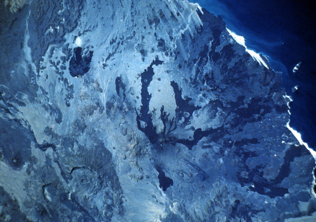
Dubbi, located east of the Erta Ale Range and south of the crystalline basement rocks of the Danakil Alps, is a large volcanic massif that rises above the western shore of the Red Sea. About 20 small cinder cones are located at the summit, and extensive basaltic lava fields to the north and NE, known as the Edd lava field, cover an area of 2700 km2 and reach the Red Sea coast. The two most-recent eruptive centers are fissure systems that extend NW-SE and NNE-SSW. The former produced lava flows that reached the Red Sea in 1400 CE. The second created 19 small craters at the summit in 1861. Ash fell more than 300 km from the volcano. Two villages were destroyed and more than 100 people were killed during Africa's largest eruption in historical time. Lava flows from the 1861 eruption traveled as far as 22 km and reached the coast.
Wikipedia 요약
두비 화산(Dubbi Volcano)은 아프리카 에리트레아에 있는 화산으로, 활화산이다. 최고 높이는 1625미터이다. 이 화산은 성층 화산으로, 1861년에 마지막으로 분화한 기록이 있다. 이 화산이 2011년에 분화했다는 말이 있으나, 이것은 매우 가까운 거리의 나브로 화산에서 분화가 일어난 것이므로 두비 화산에서 일어난 분화가 아니다.
Wikipedia · CC BY-SA · 전체 기사 보기 →
분화 이력
상세 타임라인
- 1900년VEI ?지질학적 추정1900-07-02 ~ 진행 중
- 1863년VEI 2지질학적 추정1863-07-02 ~ 진행 중
- 1861년VEI 3관측 기록1861-05-08 ~ 1861-10-16
- 1400년VEI 2관측 기록1400-07-15 ~ 진행 중
외부 링크
⚠ 참고용 정보입니다. 재난 대응에 사용하지 마세요.