Bilate River Field
화산대지 · Ethiopia · 1700m
- 화산 유형
- 화산대지
- 국가
- Ethiopia
- 지역
- 동아프리카 / Main Ethiopian Rift Volcanic Province
- 해발
- 1700m
- 좌표
- 7.070, 38.100
- 마지막 분화
- 미확인
- 판구조 환경
- Intraplate / Continental crust (> 25 km)
- 화산 지형
- Cluster
- 주요 암석
- No Data (checked)
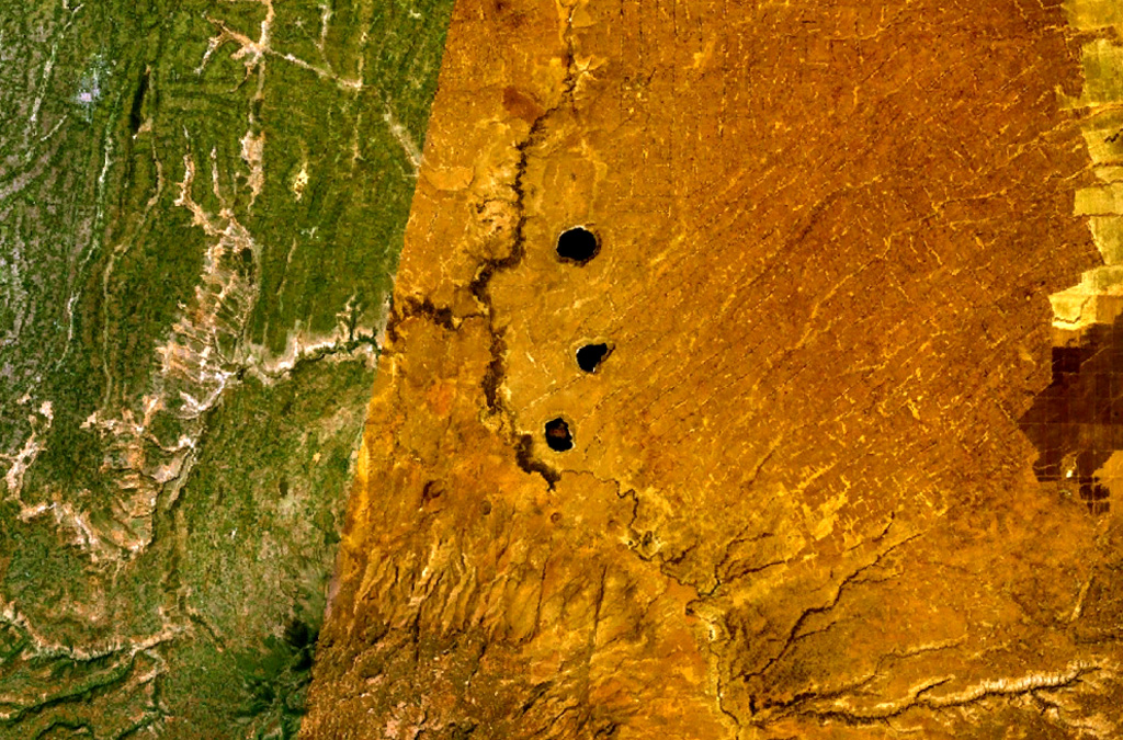
지질학적 요약
The Bilate River basin west of Lake Awasa contains a group of lake-filled maars and tuff rings of Pleistocene and probable Holocene age (WoldeGabriel 1987, pers. comm.). Active hot springs and fumaroles are located in this area.
분화 이력
상세 타임라인
분화 기록이 없습니다.
외부 링크
- 한국어 Wikipedia에 아직 기사가 없습니다. Wikidata에서 작성할 수 있습니다.
- 🔗 Smithsonian GVP 원본 페이지
⚠ 참고용 정보입니다. 재난 대응에 사용하지 마세요.