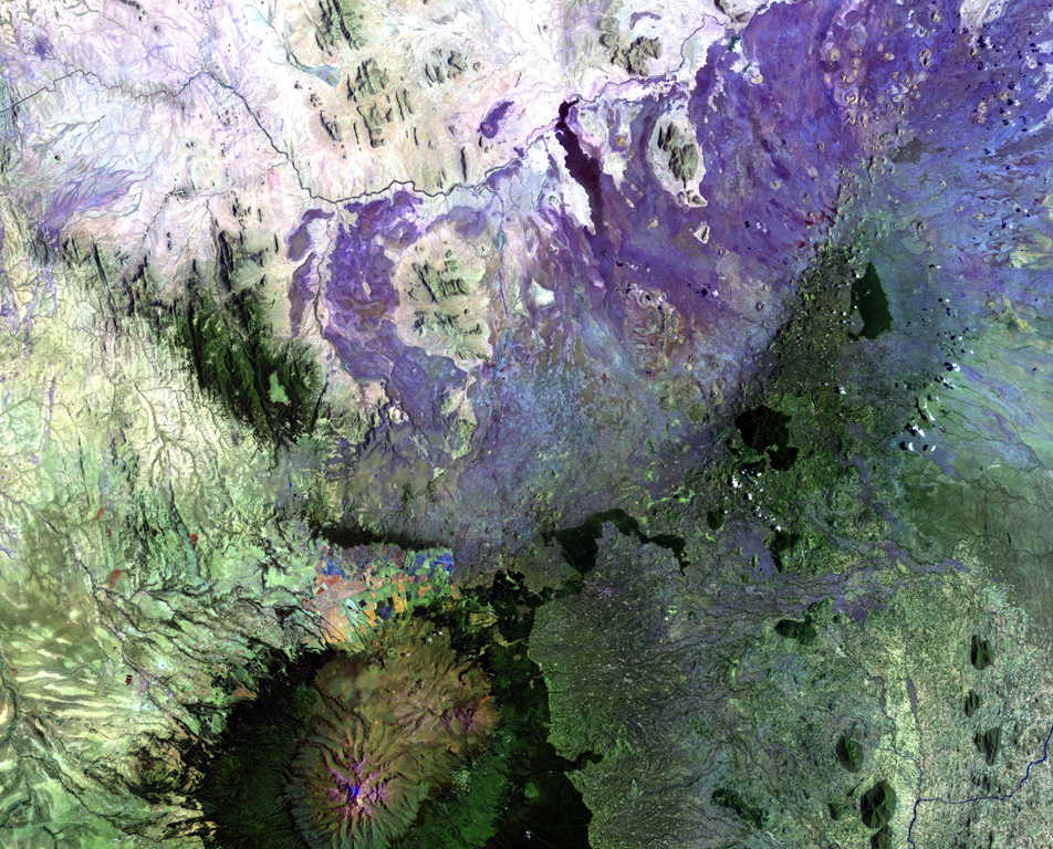
본문으로 건너뛰기

Nyambeni Hills

순상화산 · Kenya · 750m

The broad NE-SW-trending Nyambeni Hills shield volcano cuts diagonally across this NASA Landsat image from the center to the upper right. It is located NE of the eroded Pleistocene Mount Kenya volcano (lower left) and is capped by numerous phonolitic lava domes and basaltic cones and lava flows. The basaltic scoria cones are the youngest features of Nyambeni Hills volcano and are clustered in a NE-trending belt along the crest of the shield and in N-S-trending areas on its flanks.
The broad NE-SW-trending Nyambeni Hills shield volcano cuts diagonally across this NASA Landsat image from the center to the upper right. It is located NE of the eroded Pleistocene Mount Kenya volcano (lower left) and is capped by numerous phonolitic lava domes and basaltic cones and lava flows. The basaltic scoria cones are the youngest features of Nyambeni Hills volcano and are clustered in a NE-trending belt along the crest of the shield and in N-S-trending areas on its flanks. · 사진: NASA Landsat image, 1999 (courtesy of Hawaii Synergy Project, Univ. of Hawaii Institute of Geophysics & Planetology).
화산 유형
순상화산
국가
Kenya
지역
Eastern Africa Volcanic Regions / Kenyan Rift Volcanic Province
해발
750m
좌표
0.230, 37.870
마지막 분화
미확인
판구조 환경
Rift zone / Continental crust (> 25 km)
화산 지형
Shield
주요 암석
Basalt / Picro-Basalt
지질학적 요약

The broad NE-SW-trending Nyambeni shield volcano is capped by numerous phonolitic lava domes, basaltic cones, and lava flows of late-Pleistocene to Holocene age (Hackman et al., 1989). The basaltic cinder cones are the youngest features. They are clustered in a NE-trending belt along the crest of the shield, in a N-S-trending area including the Mula Hills, and in the Giaki area.

분화 이력

상세 타임라인

분화 기록이 없습니다.

외부 링크

⚠ 참고용 정보입니다. 재난 대응에 사용하지 마세요.