Rumble V Seamount
Rumble V
성층화산 · New Zealand · 400m (해저)
- 화산 유형
- 성층화산
- 국가
- New Zealand
- 지역
- 통가·케르마덱 / Southern Kermadec Volcanic Arc
- 해발
- 400m (해저)
- 좌표
- -36.142, 178.196
- 마지막 분화
- 미확인
- 판구조 환경
- Subduction zone / Oceanic crust (< 15 km)
- 화산 지형
- Composite
- 주요 암석
- Andesite / Basaltic Andesite
지질학적 요약
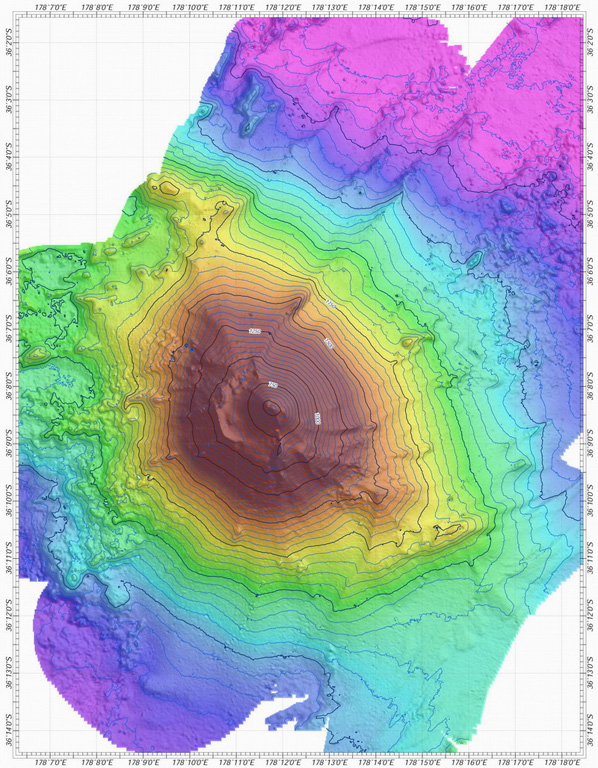
Rumble V was discovered in 1992 at the southernmost end of the Rumble seamounts on the southern Kermadec Ridge, 17 km ESE of Rumble IV. Andesitic and basaltic andesite rocks have been dredged from this volcano, which rises more than 2,000 m to nearly 400 m below the ocean surface and shows a pristine morphology. A large plume of gas bubbles was acoustically detected rising from the summit in 1992, and subsequent expeditions detected evidence of vigorous hydrothermal activity.
분화 이력
상세 타임라인
분화 기록이 없습니다.
외부 링크
- 한국어 Wikipedia에 아직 기사가 없습니다. Wikidata에서 작성할 수 있습니다.
- 🔗 Smithsonian GVP 원본 페이지
⚠ 참고용 정보입니다. 재난 대응에 사용하지 마세요.