Hargy
성층화산 · Papua New Guinea · 1148m
- 화산 유형
- 성층화산
- 국가
- Papua New Guinea
- 지역
- 남서태평양 / Bismarck Volcanic Arc
- 해발
- 1148m
- 좌표
- -5.330, 151.100
- 마지막 분화
- 950년
- 판구조 환경
- Subduction zone / Continental crust (> 25 km)
- 화산 지형
- Composite
- 주요 암석
- Dacite
지질학적 요약
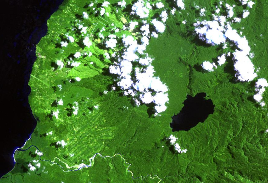
This little-known volcano is one of several major calderas on the island of New Britain. The 10 x 12 km Hargy caldera, whose floor is 150 m above sea level, contains an inner caldera with a steep west-facing wall. A caldera lake on the SE side drains through a narrow gap in the northern caldera wall. The latest caldera-forming eruption of Hargy volcano took place about 11,000 years ago. The dacitic Galloseulo lava cone rises above and partially overtops the western rim of the caldera. A double crater occupies a larger 700-m-wide crater. Numerous small eruptions have taken place at Galloseulo over the past 7000 years, the last occurring about 1000 years ago.
Wikipedia 요약
영어 요약Hargy is a large volcanic caldera on the island of New Britain, Papua New Guinea. The caldera measures 12 km (7.5 mi) by 10 km (6.2 mi), and its floor is located at 150 m (490 ft) above sea level. It also hosts an inner-caldera with a steep west-facing wall. Lake Hargy, located within the caldera, drains through a narrow river that runs along the northern wall. The caldera-forming eruption occurred approximately 11,000 years ago. At the western part of the caldera rises Galloseulo, a post-caldera dacitic lava cone with a 700 m (2,300 ft)-wide crater, occupied by a pair of smaller craters. Galloseulo has produced many small eruptions in the past 7,000 years, with the most recent in 950 CE. In September 1990, minor fumarolic activity was observed in the western summit crater of Galloseulo.
Wikipedia · CC BY-SA · 전체 기사 보기 →
분화 이력
상세 타임라인
- 950년VEI ?지질학적 추정950 ~ 진행 중Galloseulo
- 기원전 5050년VEI ?지질학적 추정BCE 5050 ~ 진행 중Galloseulo
외부 링크
⚠ 참고용 정보입니다. 재난 대응에 사용하지 마세요.