Gunung Patah
Patah
성층화산 · Indonesia · 2836m
- 화산 유형
- 성층화산
- 국가
- Indonesia
- 지역
- 순다·반다 / Sunda Volcanic Arc
- 해발
- 2836m
- 좌표
- -4.257, 103.306
- 마지막 분화
- 미확인
- 판구조 환경
- Subduction zone / Continental crust (> 25 km)
- 화산 지형
- Composite
- 주요 암석
- No Data (checked)
지질학적 요약
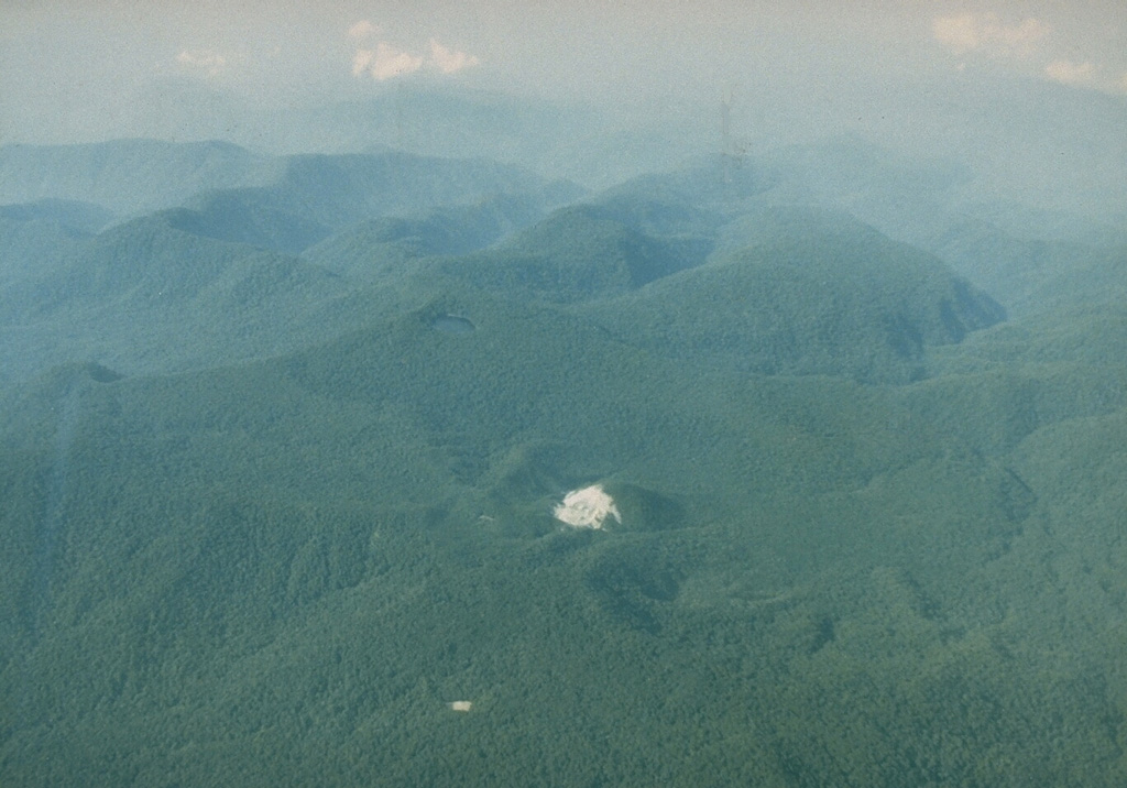
Patah is a heavily forested, dissected Quaternary volcano SE of Dempo volcano. The age of its latest eruptions is not known, although on 1 May 1989 a possible new 150-m-wide crater with active fumaroles was observed by a cargo aircraft pilot in a heavily forested area on the side of a small cone about 3 km SE of Gunung Patah. The exact date of its formation, and its geologic relationship to Patah are uncertain. A crater lake at the summit of another peak, Bukit Belirang (Sulfur Hill), is located 1.5 km S of the fumaroles.
Wikipedia 요약
영어 요약Mount Patah is the highest mountain in the Indonesian province of Bengkulu, it is a heavily forested quaternary age volcano southeast of Mount Dempo on Sumatra island, Indonesia. On 1 May 1989, a fumarole activity was observed by a pilot near the summit. The exact location of the crater, the date of its formation and its geologic relationship is uncertain.
Wikipedia · CC BY-SA · 전체 기사 보기 →
분화 이력
상세 타임라인
분화 기록이 없습니다.
외부 링크
⚠ 참고용 정보입니다. 재난 대응에 사용하지 마세요.