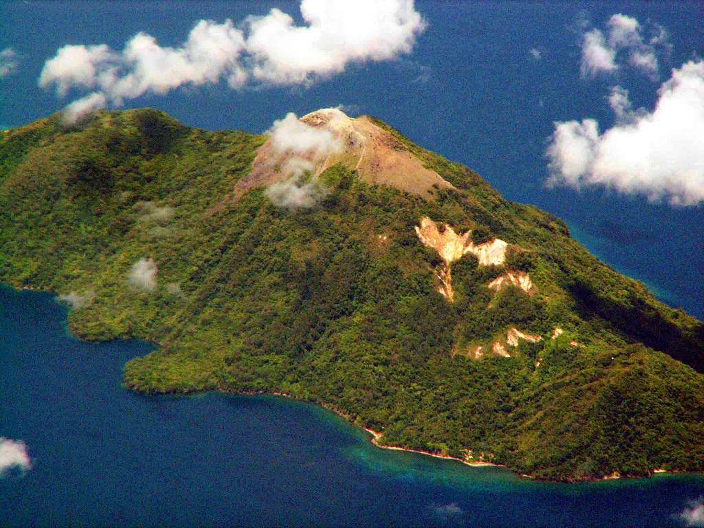
Mount Serua
Serua
성층화산 · Indonesia · 608m
- 화산 유형
- 성층화산
- 국가
- Indonesia
- 지역
- 순다·반다 / Inner Banda Volcanic Arc
- 해발
- 608m
- 좌표
- -6.312, 130.017
- 마지막 분화
- 1921년
- 판구조 환경
- Subduction zone / Oceanic crust (< 15 km)
- 화산 지형
- Composite
- 주요 암석
- Andesite / Basaltic Andesite
지질학적 요약
The 2 x 4 km island of Serua is the emergent summit of a volcano rising 3,600 m above the Banda Sea floor. A truncated central cone surrounded by an old crater wall is capped by the Gunung Wuarlapna lava dome. This andesitic volcano, also known as Legatala, lies near the center of the Banda arc and has had many eruptions recorded since the 17th century.
분화 이력
요약 (VEI 시계열)
막대를 클릭하면 개별 분화가 표시됩니다
상세 타임라인
- 1921년VEI 2관측 기록1921-09-18 ~ 진행 중Summit and south flank
- 1919년VEI 2관측 기록1919-11-16 ~ 진행 중
- 1859년VEI 2관측 기록1859-07-02 ~ 진행 중
- 1858년VEI 2관측 기록1858-07-02 ~ 진행 중
- 1846년VEI 2관측 기록1846-09-16 ~ 진행 중
- 1845년VEI 2지질학적 추정1845-07-02 ~ 진행 중
- 1844년VEI 2관측 기록1844-08-16 ~ 1844-09-16
- 1694년VEI 3관측 기록1694 ~ 진행 중
- 1693년VEI 4관측 기록1693-06-04 ~ 1693-07
- 1692년VEI ?지질학적 추정1692-06-04 ~ 진행 중
- 1687년VEI 3관측 기록1687-06-15 ~ 진행 중
- 1683년VEI 3관측 기록1683 ~ 진행 중
외부 링크
⚠ 참고용 정보입니다. 재난 대응에 사용하지 마세요.