Kita-Bayonnaise
칼데라 · Japan · 360m (해저)
- 화산 유형
- 칼데라
- 국가
- Japan
- 지역
- 북서태평양 / Izu Volcanic Arc
- 해발
- 360m (해저)
- 좌표
- 32.100, 139.850
- 마지막 분화
- 미확인
- 판구조 환경
- Subduction zone / Oceanic crust (< 15 km)
- 화산 지형
- Caldera
- 주요 암석
- Rhyolite
지질학적 요약
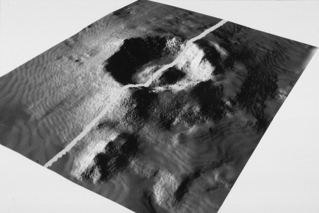
The large submarine Kita-Bayonnaise (North Bayonnaise) submarine caldera, also known as Myojin Knoll, lies between the Aogashima and Myojinsho (also called Beyonesu Rocks) calderas abotu 300 km SSE of the Izu Peninsula. The 6-7 km wide caldera has walls 500-900 m high that reveal rhyolitic lava flows, shallow intrusions, and volcaniclastic deposits. The high point on the western rim is a pumice-mantled remnant of the pre-collapse volcanic complex that reaches a depth of 360 m. A voluminous deposit of coarse rhyolitic pumice from the caldera-forming eruption covers the rim and outer flanks. Post-caldera eruptions formed a lava dome that rises 250 m above the caldera floor. The age of the caldera is not known, but was considered by Fiske et al. (2001) to perhaps be as young as a few thousand years. An active hydrothermal vent field lies on the eastern caldera floor and has produced a polymetallic sulfide deposit from vent chimneys up to 30 m high that emit fluids as hot as 278°C.
분화 이력
상세 타임라인
분화 기록이 없습니다.
외부 링크
- 한국어 Wikipedia에 아직 기사가 없습니다. Wikidata에서 작성할 수 있습니다.
- 🔗 Smithsonian GVP 원본 페이지
⚠ 참고용 정보입니다. 재난 대응에 사용하지 마세요.