Kinenin
마르 · Russia · 583m
- 화산 유형
- 마르
- 국가
- Russia
- 지역
- 북서태평양 / Central Kamchatka Volcanic Arc
- 해발
- 583m
- 좌표
- 57.350, 160.970
- 마지막 분화
- 850년
- 판구조 환경
- Subduction zone / Continental crust (> 25 km)
- 화산 지형
- Minor
- 주요 암석
- Basalt / Picro-Basalt
지질학적 요약
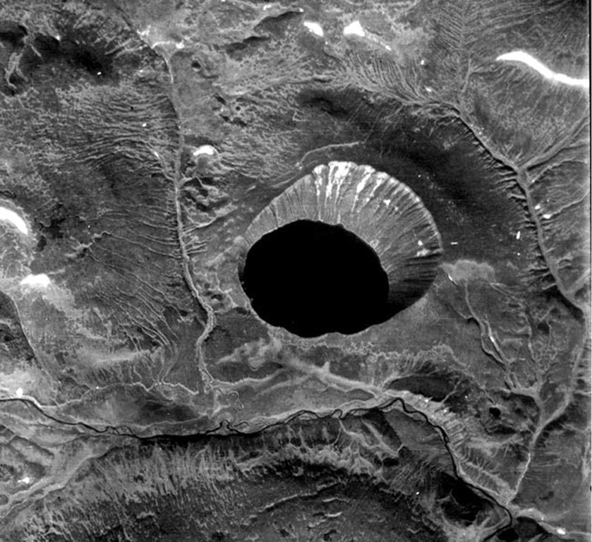
Kinenin maar lies at the eastern foot of the Sredinny Range, about 80 km NNW of Sheveluch volcano. The 2.5-km-wide, funnel-shaped maar was formed along the Kinenin River, a tributary of the Elovka. It is partially filled by a 1-km-wide lake whose surface is at 400 m elevation. The eastern rim at about 580 m is the high point of the crater. The eruption of Kinenin took place about 1,100 years ago, making it the youngest known maar in Kamchatka. Both silicic pyroclastic flows and mafic pyroclastic ejecta were produced, which were distributed primarily to the ENE. The location is north of the active Kamchatka subduction zone.
분화 이력
요약 (VEI 시계열)
막대를 클릭하면 개별 분화가 표시됩니다
상세 타임라인
- 850년 (±50년)VEI 4지질학적 추정850 ~ 진행 중
외부 링크
- 한국어 Wikipedia에 아직 기사가 없습니다. Wikidata에서 작성할 수 있습니다.
- 🔗 Smithsonian GVP 원본 페이지
⚠ 참고용 정보입니다. 재난 대응에 사용하지 마세요.