Buzzard Creek
응회환 · United States · 830m
- 화산 유형
- 응회환
- 국가
- United States
- 지역
- 북아메리카 / Alaska Peninsula Volcanic Arc
- 해발
- 830m
- 좌표
- 64.062, -148.433
- 마지막 분화
- -1050년
- 판구조 환경
- Subduction zone / Continental crust (> 25 km)
- 화산 지형
- Minor (Basaltic)
- 주요 암석
- Basalt / Picro-Basalt
지질학적 요약
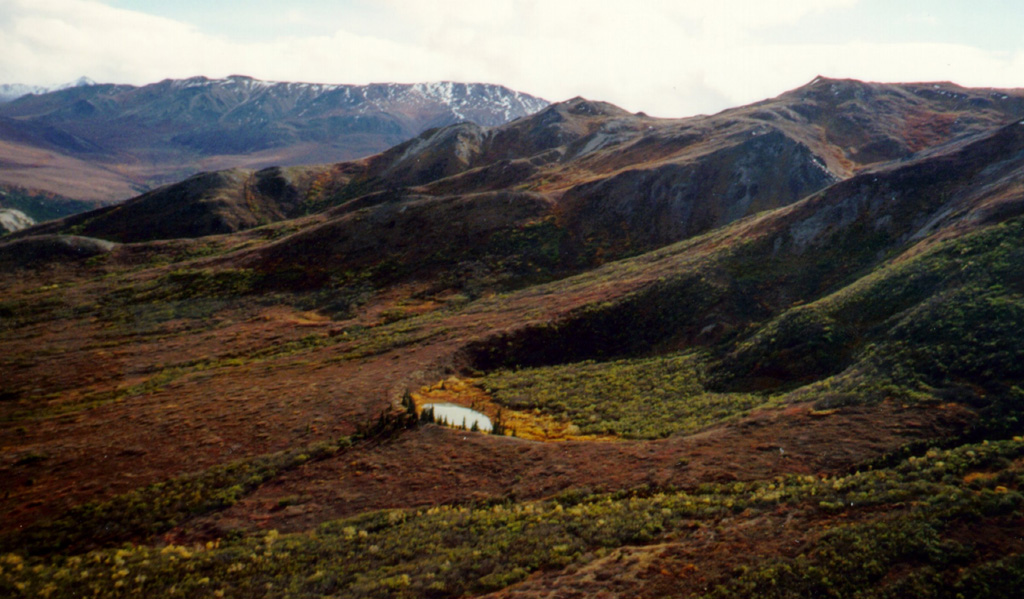
Two Holocene tuff rings form craters 300 and 66 m wide near the headwaters of Buzzard Creek at the northern foot of the central Alaska Range NE of the town of Healy along the Parks Highway. Both contain small lakes, and the smaller ring is about 200 m SE of the larger one. The total volume of ejecta, most of which is accessory material, probably does not exceed 0.001 km3. The ejecta overlies young glacial terraces that correlate with a glacial stage that ended about 10,000 years ago, and radiocarbon dates give an age for the eruption that formed the tuff rings of about 3,000 years. This minor volcanic feature lies along trend with the Aleutian arc, but is located 320 km NE of its nearest Holocene neighbor (Hayes volcano), and directly over the northernmost corner of the subducting Pacific Plate.
Wikipedia 요약
영어 요약The Buzzard Creek craters are two tuff rings near Healy, Alaska, United States. Its highest point is 2,723 ft.
Wikipedia · CC BY-SA · 전체 기사 보기 →
분화 이력
상세 타임라인
- 기원전 1050년VEI 2지질학적 추정BCE 1050 ~ 진행 중
외부 링크
⚠ 참고용 정보입니다. 재난 대응에 사용하지 마세요.