Bridge River Cones
화산대지 · Canada · 2500m
- 화산 유형
- 화산대지
- 국가
- Canada
- 지역
- 북아메리카 / Garibaldi Volcanic Arc
- 해발
- 2500m
- 좌표
- 50.800, -123.400
- 마지막 분화
- 미확인
- 판구조 환경
- Subduction zone / Continental crust (> 25 km)
- 화산 지형
- Cluster
- 주요 암석
- Basalt / Picro-Basalt
지질학적 요약
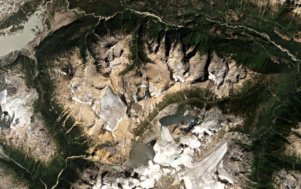
The Bridge River Cones volcanic field consists of a group of small basaltic and trachybasaltic eruptive centers at the extreme northern end of the Garibaldi volcanic belt in SW British Columbia. Pleistocene volcanic necks and cones were Potassium-Argon dated at 0.97 and 0.59 million years ago in the Salal Creek area and display ice-contact features (Lawrence et al., 1984). Tuber Hill is a small subaerial 600,000-year-old basaltic stratovolcano to the N that was constructed on the Bridge River upland when neighboring valleys were filled with ice. Lava flows that overlie poorly consolidated glacial till and appear to post-date the latest glaciation are found immediately N of Bridge River. The youngest flow may be less than 1500 years old (Souther; in Wood and Kienle, 1990).
Wikipedia 요약
영어 요약The Bridge River Cones, sometimes referred to as the Lillooet Cones and Salal Creek Cones, is the name given to a volcanic field located on the north flank of the upper Bridge River, about 40 km (25 mi) west of the town of Gold Bridge. The cones are in the lee of the Lillooet Icecap and sit astride a group of passes between the Bridge River, which flows W-E to their south, and the Lord River, which flows north to the Taseko Lakes in the Chilcotin District.
Wikipedia · CC BY-SA · 전체 기사 보기 →
분화 이력
상세 타임라인
분화 기록이 없습니다.
외부 링크
⚠ 참고용 정보입니다. 재난 대응에 사용하지 마세요.