Cleft Segment
열극 분화구 · Undersea Features · 2140m (해저)
- 화산 유형
- 열극 분화구
- 국가
- Undersea Features
- 지역
- 동태평양 / Northeast Pacific Rifts Volcanic Province
- 해발
- 2140m (해저)
- 좌표
- 44.830, -130.300
- 마지막 분화
- 1986년
- 판구조 환경
- Rift zone / Oceanic crust (< 15 km)
- 화산 지형
- Cluster
- 주요 암석
- Basalt / Picro-Basalt
지질학적 요약
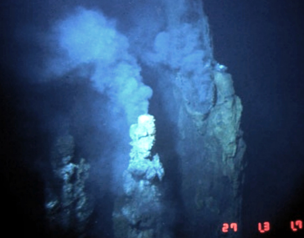
The Cleft Segment, the southernmost of the Juan de Fuca Ridge, lies immediately north of the Blanco Fracture Zone. The 80-km-long segment is named for a nearly continuous 10-km-long, 30-50 m wide cleft at its southern end. Two episodes of seafloor spreading were documented along the northern part of the segment in the 1980's. Bathymetric surveys indicated that a series of discontinuous pillow-lava mounds were extruded along a 17-km-long fissure between 1981 and 1987. The eruption possibly coincided with emission of a large plume of hot mineral-laden water in 1986. The location is at a depth of about 2,300 m near the northern edge of the Cleft segment and the southern end of the Vance segment of the Juan de Fuca Ridge, about 500 km W of the central Oregon coast. Youthful sheet-lava flows immediately south of the pillow lavas were estimated to be only a few years older.
분화 이력
상세 타임라인
- 1986년VEI 0관측 기록1986-08-16 ~ 진행 중N Cleft Segment, S Juan de Fuca Ridge
- 1982년VEI 0관측 기록1982-07-02 ~ 진행 중N Cleft Segment, S Juan de Fuca Ridge
- 기원전 270년VEI 0지질학적 추정BCE 270 ~ 진행 중S Cleft Segment, S Juan de Fuca Ridge
외부 링크
- 한국어 Wikipedia에 아직 기사가 없습니다. Wikidata에서 작성할 수 있습니다.
- 🔗 Smithsonian GVP 원본 페이지
⚠ 참고용 정보입니다. 재난 대응에 사용하지 마세요.