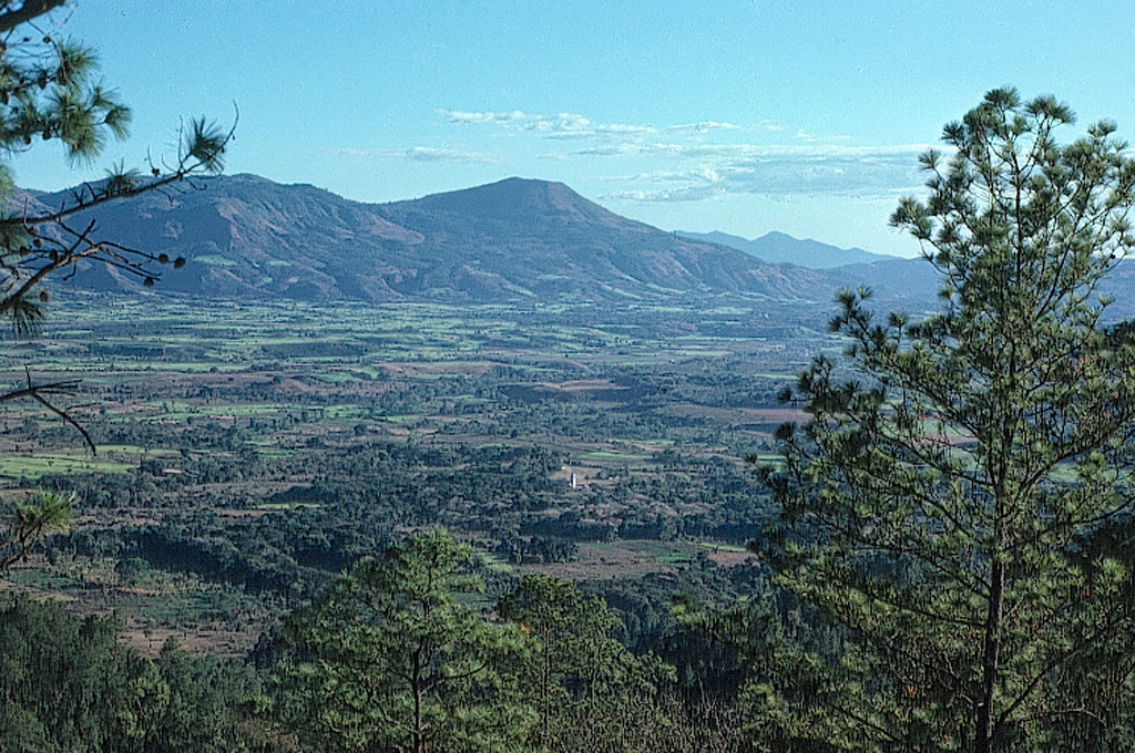
Volcán Jumaytepeque
Jumaytepeque
성층화산 · Guatemala · 1802m
- 화산 유형
- 성층화산
- 국가
- Guatemala
- 지역
- 중앙아메리카·카리브해 / Central America Volcanic Arc
- 해발
- 1802m
- 좌표
- 14.340, -90.271
- 마지막 분화
- 미확인
- 판구조 환경
- Subduction zone / Continental crust (> 25 km)
- 화산 지형
- Composite
- 주요 암석
- Basalt / Picro-Basalt
지질학적 요약
Jumaytepeque is a small basaltic stratovolcano located NNE of the city of Cuilapa, north of the major NW-SE-trending Jalpatagua fault that cuts diagonally across SE Guatemala. The volcano was constructed near the SE rim of the large Miocene Santa Rosa de Lima caldera. It is not overlain by a ca. 23,000-year-old tephra unit from nearby Ayarza caldera, and its erosionally unmodified form suggests that Holocene activity is possible (Reynolds 2007, pers. comm.). Two older cinder cones to the north are covered with Ayarza tephra.
Wikipedia 요약
영어 요약Volcán Jumaytepeque is a stratovolcano in south-eastern Guatemala. The 1,815-metre-high (5,955 ft) volcano is located about 7 km north-north-east of the city of Cuilapa, near the south-eastern rim of the large Miocene Santa Rosa de Lima caldera.
Wikipedia · CC BY-SA · 전체 기사 보기 →
분화 이력
상세 타임라인
분화 기록이 없습니다.
외부 링크
⚠ 참고용 정보입니다. 재난 대응에 사용하지 마세요.