Cayutue-La Vigueria
화산대지 · Chile · 506m
- 화산 유형
- 화산대지
- 국가
- Chile
- 지역
- 남아메리카 / Southern Andean Volcanic Arc
- 해발
- 506m
- 좌표
- -41.300, -72.270
- 마지막 분화
- -190년
- 판구조 환경
- Subduction zone / Continental crust (> 25 km)
- 화산 지형
- Cluster
- 주요 암석
- Basalt / Picro-Basalt
지질학적 요약
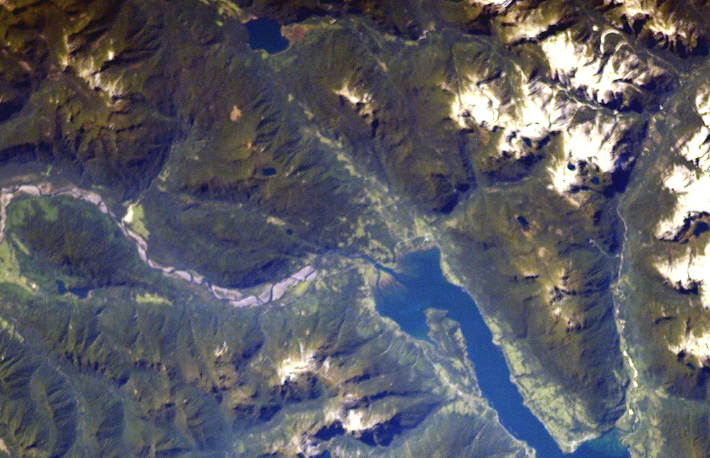
The Cayutué-La Viguería volcanic field consists of about 20 basaltic maars and cinder cones of Holocene age along the N-S-trending Liquiñe-Ofqui fault zone. The field occupies a low-lying area between the southern end of Ensenada Cayutué (the southern extension of Lake Todos los Santos) and the northern end of the Estuario Reloncaví. La Viguería and Volcán Cayutué are the principal cones. Formation of La Viguería and associated lava flows temporarily dammed the Río Petrohué about 3,000 years ago, forming an ephemeral lake that was filled with deposits from Calbuco and Osorno volcanoes. Pyroclastic cones and lava flows filled the Ensenada de Cayutué depression, separating Lake Todos los Santos from Ralún Bay.
분화 이력
상세 타임라인
- 기원전 190년 (±190년)VEI ?지질학적 추정BCE 190 ~ 진행 중La Viguería
외부 링크
- 한국어 Wikipedia에 아직 기사가 없습니다. Wikidata에서 작성할 수 있습니다.
- 🔗 Smithsonian GVP 원본 페이지
⚠ 참고용 정보입니다. 재난 대응에 사용하지 마세요.