Crater Basalt Volcanic Field
화산대지 · Argentina · 1344m
- 화산 유형
- 화산대지
- 국가
- Argentina
- 지역
- 남아메리카 / Southern Andean Volcanic Arc
- 해발
- 1344m
- 좌표
- -42.018, -70.194
- 마지막 분화
- 미확인
- 판구조 환경
- Intraplate / Continental crust (> 25 km)
- 화산 지형
- Cluster
- 주요 암석
- Trachybasalt / Tephrite Basanite
지질학적 요약
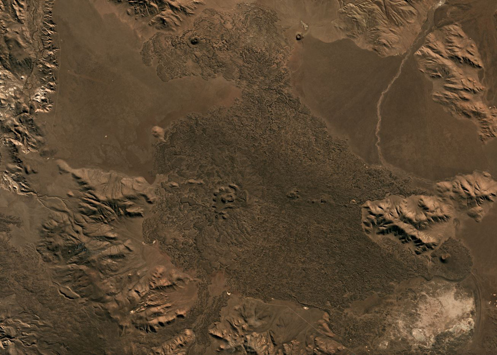
The Crater Basalt volcanic field in the northern Patagonia region of Argentina covers an area of about 700 km2. The field lies about 400 km E of the Peru-Chile trench along the broad regional Gastre fault system. Nine cinder cones and spatter cones produced blocky lava flows of alkali basaltic, basanitic, and trachybasaltic composition. One of the largest features is Cerro Fermín, a cinder cone that produced multiple lava flows. The highest cone, Cerro Negro, fed lava flows that traveled to the W, E, and then NE, where its distal margin is cut by a provincial road. Some of the lava flows, such as those from Cerro Ventana and Cerro Contreras, cover Holocene shorelines of playa lakes.
분화 이력
상세 타임라인
분화 기록이 없습니다.
외부 링크
- 한국어 Wikipedia에 아직 기사가 없습니다. Wikidata에서 작성할 수 있습니다.
- 🔗 Smithsonian GVP 원본 페이지
⚠ 참고용 정보입니다. 재난 대응에 사용하지 마세요.