Brennisteinsfjöll
Brennisteinsfjoll
화구열 · Iceland · 610m
- 화산 유형
- 화구열
- 국가
- Iceland
- 지역
- 대서양 / Iceland Neovolcanic Rift Volcanic Province
- 해발
- 610m
- 좌표
- 63.933, -21.783
- 마지막 분화
- 1341년
- 판구조 환경
- Rift zone / Oceanic crust (< 15 km)
- 화산 지형
- Cluster
- 주요 암석
- Basalt / Picro-Basalt
지질학적 요약
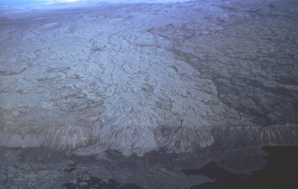
The Brennisteinsfjöll volcanic system, located east of Kleifarvatn lake, consists of a series of NE-SW-trending crater rows and small shield volcanoes. Postglacial and historical basaltic lavas cover a wide area. An eruption in 1000 CE was dated by its occurrence at the time of a meeting of the Icelandic outdoor parliament at Thingvellier. The most recent eruption took place in the 14th century.
Wikipedia 요약
영어 요약Brennisteinsfjöll is a minor volcanic system, with crater rows and small shield volcanoes on the Reykjanes Peninsula in southwest Iceland.
Wikipedia · CC BY-SA · 전체 기사 보기 →
분화 이력
요약 (VEI 시계열)
막대를 클릭하면 개별 분화가 표시됩니다
상세 타임라인
- 1341년 (±1년)VEI 2관측 기록1341 ~ 진행 중Grafeldur (Selvogshraun)
- 1200년VEI 2지질학적 추정1200 ~ 진행 중Kongsfell
- 1000년VEI 0관측 기록1000-06-25 ~ 진행 중Eldborg at Lambafell
- 950년VEI 2지질학적 추정950 ~ 진행 중Rjupnadyngjur
- 910년 (±75년)VEI 2지질학적 추정910 ~ 진행 중Kista (Breiddalshraun)
- 875년 (±50년)VEI 2지질학적 추정875 ~ 진행 중Tvibollar
- 기원전 1040년 (±75년)VEI 2지질학적 추정BCE 1040 ~ 진행 중Eldborg at Brennisteinsfjöllum
- 기원전 2660년 (±75년)VEI 0지질학적 추정BCE 2660 ~ 진행 중Leitin
- 기원전 9000년VEI 0지질학적 추정BCE 9000 ~ 진행 중Heidin Há
외부 링크
⚠ 참고용 정보입니다. 재난 대응에 사용하지 마세요.